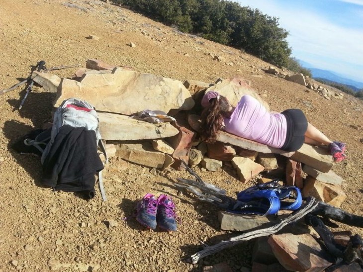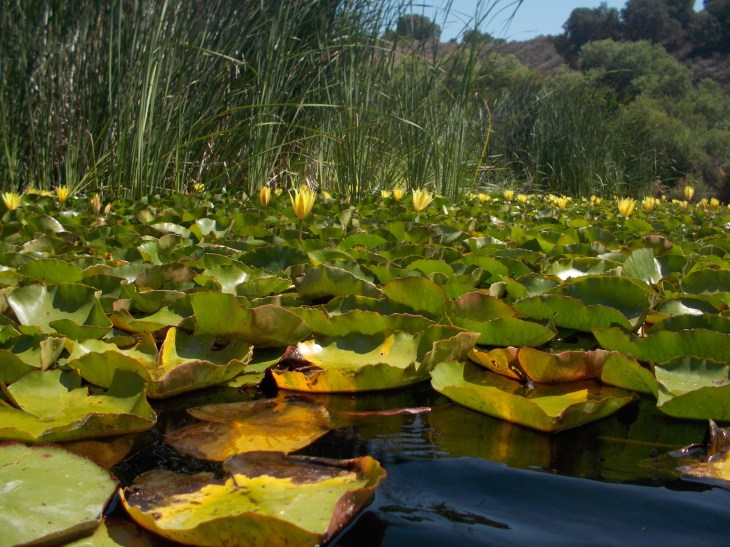
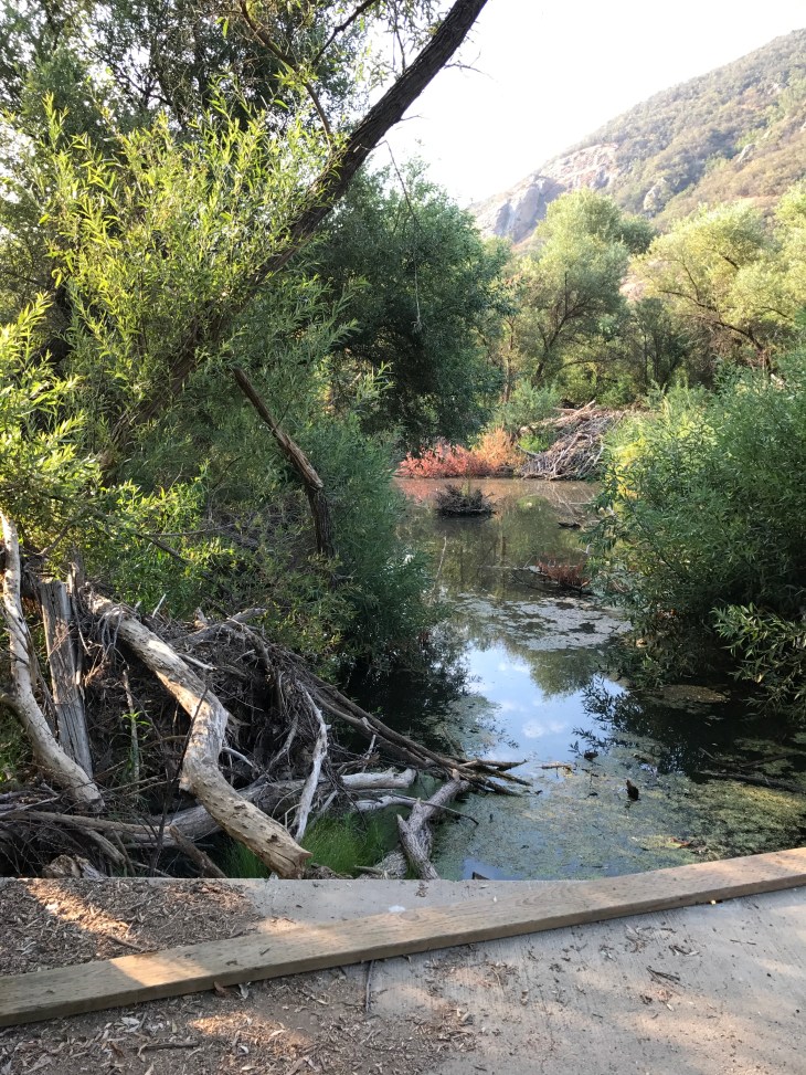
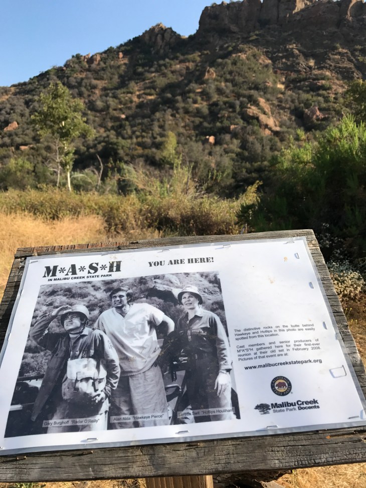
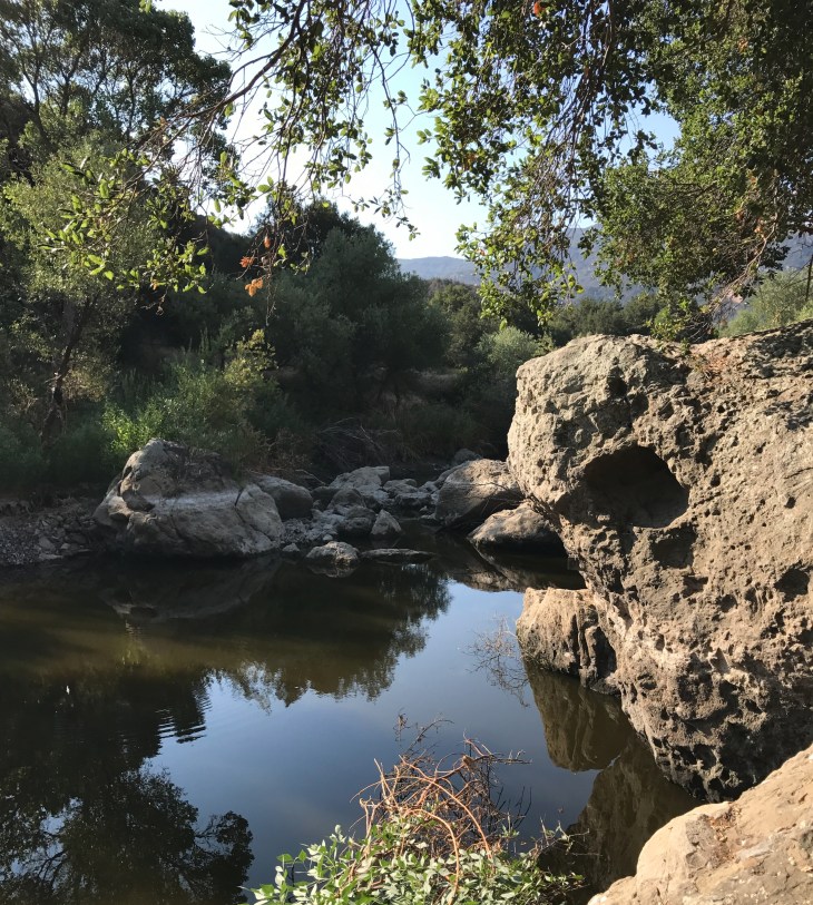
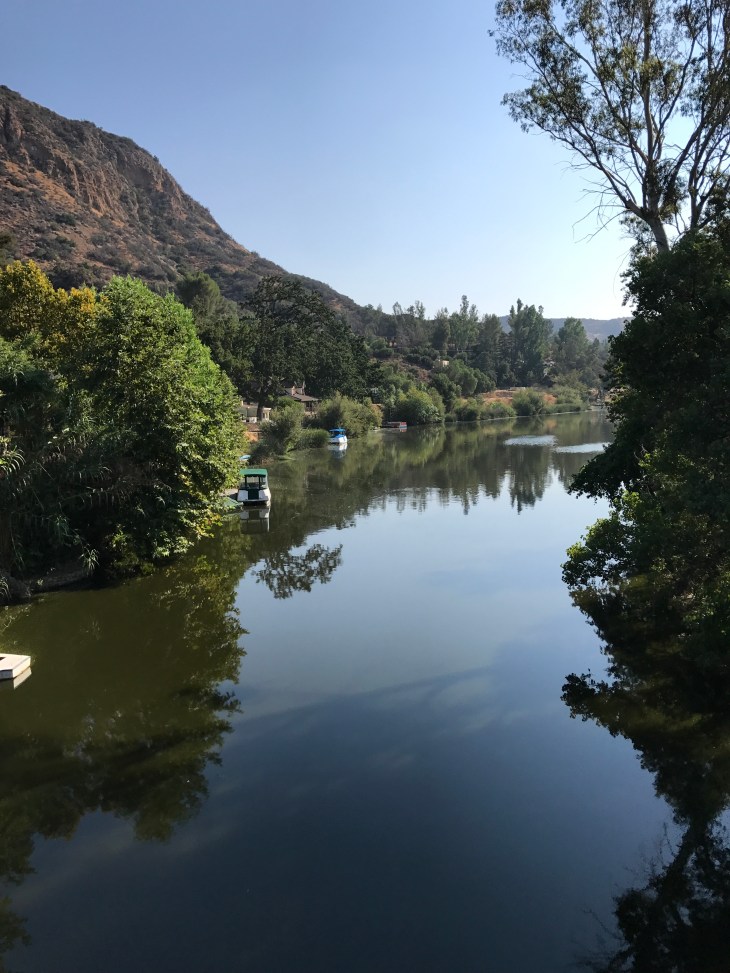
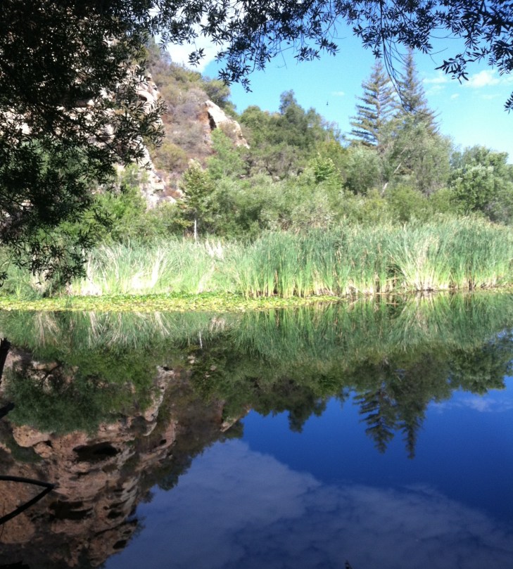
Hiking Malibu Creek State Park is fun. There are so many adventures to be had there; hiking, rock climbing and swimming are just a few. You can hike through the remains of the M*A*S*H site, a very popular television show in the 70’s. There are multiple connecting trails in the park that will keep you busy for hours. It is heavily trafficked on the weekends and wonderfully empty on weekdays. May favorite spot is the Century Lake. In 1903, the Crags Country Club constructed a 50 foot tall dam on its 2,000 acre property on what is now Malibu Creek State Park. The dam created a seven acre lake that club members used for fishing and duck hunting. The Club closed in 1936, and 10 years later, 20th Century Fox Studios purchased the property and renamed the lake Century Lake. The above photo was taken there. For this post, I would like to describe the Lower Malibu Creek Loop. This hike is 8 miles round-trip with a 224 foot elevation gain. I will also help you find the Century Lake, the Rock Pool and the rock climbing walls. Pack a picnic, you can enjoy several hours in this park. Follow this link for more park information.
The History
The Chumash inhabited the current park lands for many centuries. Many archeological sites are found in the park. A village called Ta’lopop or Ta’lepop has been uncovered in the northeast corner of the park. The name “Malibu” is attributed to the Chumash. The original form of the word used by the Chumash was hu-mal-iwo, meaning “the surf sounds loudly”. The trails you will be hiking were once the footpaths that the Chumash used to travel from village to village.
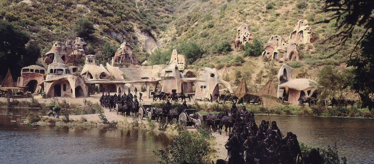
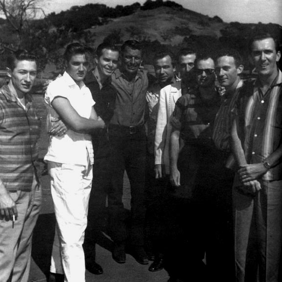
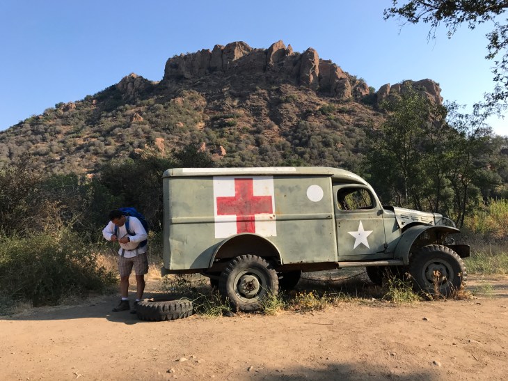
In 1946, most of the area which is now Malibu Creek State Park was purchased by 20th Century Fox and was call Fox Ranch. Hundreds of movies and television shows were filmed there. In 1956, Elvis Presley was filmed there in Love Me Tender and Marilyn Monroe was seen on the ranch filming The Seven Year Itch. The TV shows Daniel Boone and M*A*S*H (see opening credits filmed on site) were filmed there. Scenes from Butch Cassidy and The Sundance Kid (you can see the jump right here) were filmed there. In 1968 the original Planet of the Apes (film clip) was filmed around Century Lake. The last large production shot in the park was Pleasantville (1998) with Tobey McGuire and Reese Witherspoon. The entire 1950’s town seen in the film was constructed on top of what is now the lower parking lot. When you drive in that lot, you will be driving on the old streets of a movie set.
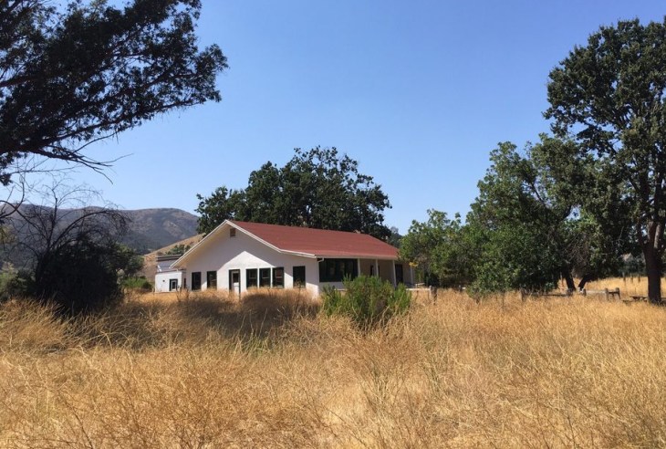
One of the park’s point of interest is the Sepulveda Adobe which was constructed in 1863. It was the home of California pioneer homesteader Don Pedro Alcantra Sepulveda. Pedro Sepulveda and his wife Soledad raised their twelve children at this small home. A mulberry tree planted by Don Pedro well over 100 years ago thrives today and is still bearing fruit. The Sepulveda Adobe was inhabited from the time of its construction until 1980. It was badly damaged by an earthquake in 1994. It was restored in 2003 and is open to the public.
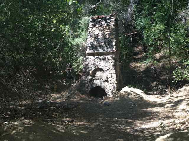
In the early 1900’s another adobe was built along Malibu Creek by Johnny Mott, a famous LA attorney. President Herbert Hoover was said to be a frequent visitor there. Only the stone fireplace remains and it is known today as the Mott ruins.
The area which is now Malibu Creek State Park was at one time divided between Bob Hope, Ronald Reagan and 20th Century Fox. Ronald Reagan owned a large ranch on the site from 1951 to 1966. His ranch was known as Yearling Row. He sold the ranch to 20th Century Fox in 1966 to pay campaign debts from his 1966 governor’s campaign. Much of the land holdings which are now the park were donated by Bob Hope. 20th Century Fox sold the land to the State of California in 1974. Malibu Creek State Park was officially opened in 1976. By 2004, Malibu Creek State Park represented one of the largest public owned parcels in the State of California.
Hike Stats
Type of Route: Out and Back
Distance: 8.0 miles
Elevation Gain: 224 feet
Time: 3-5 hours
Difficulty: Easy to Moderate-ish (it is 8 miles)
Dogs Permitted: Dogs on a leash are allowed in the park’s day use areas and campground. Dogs are not allowed on the backcountry trails or dirt roads.
Permit: None. There is a park entry fee of $12.00
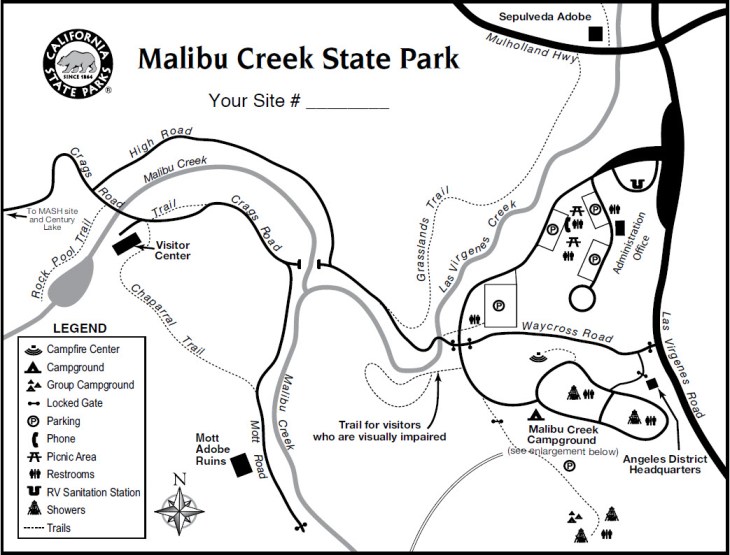
This link will take you to more specific directions for the Lower Malibu Creek Loop hike.
The Hike
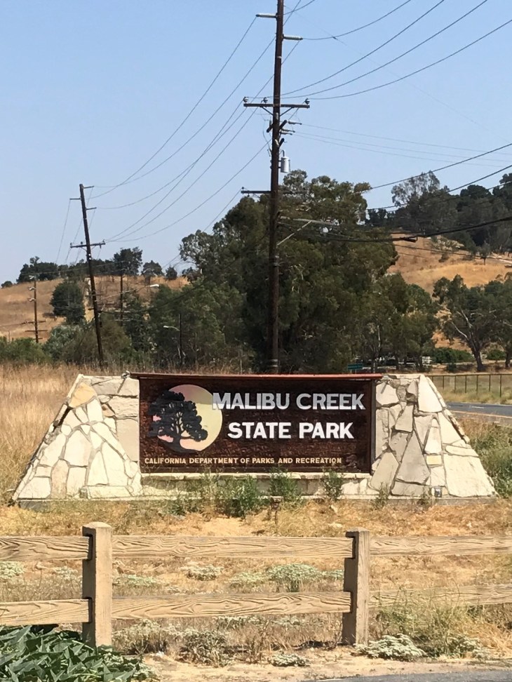
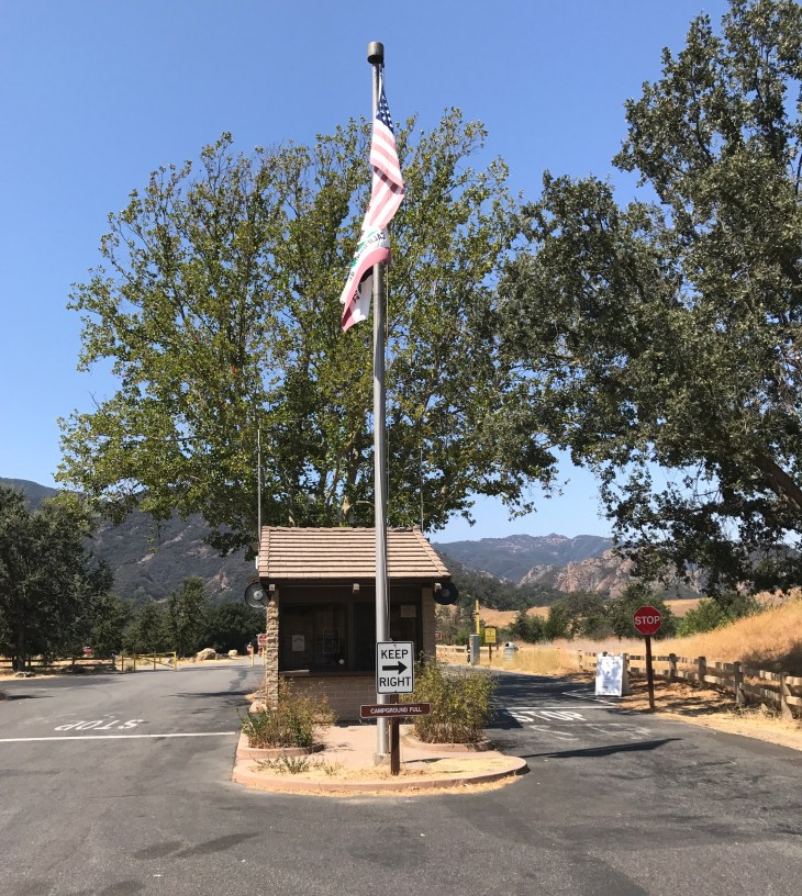
I enter the park from Las Virgenes Road. The entrance to the park is well marked. The day pass is $12.00, though there are cheaper rates if you only plan to stay 1-3 hours. Many people park their cars outside of the park to avoid the fee and hike in from Las Virgenes to the backcountry trails.
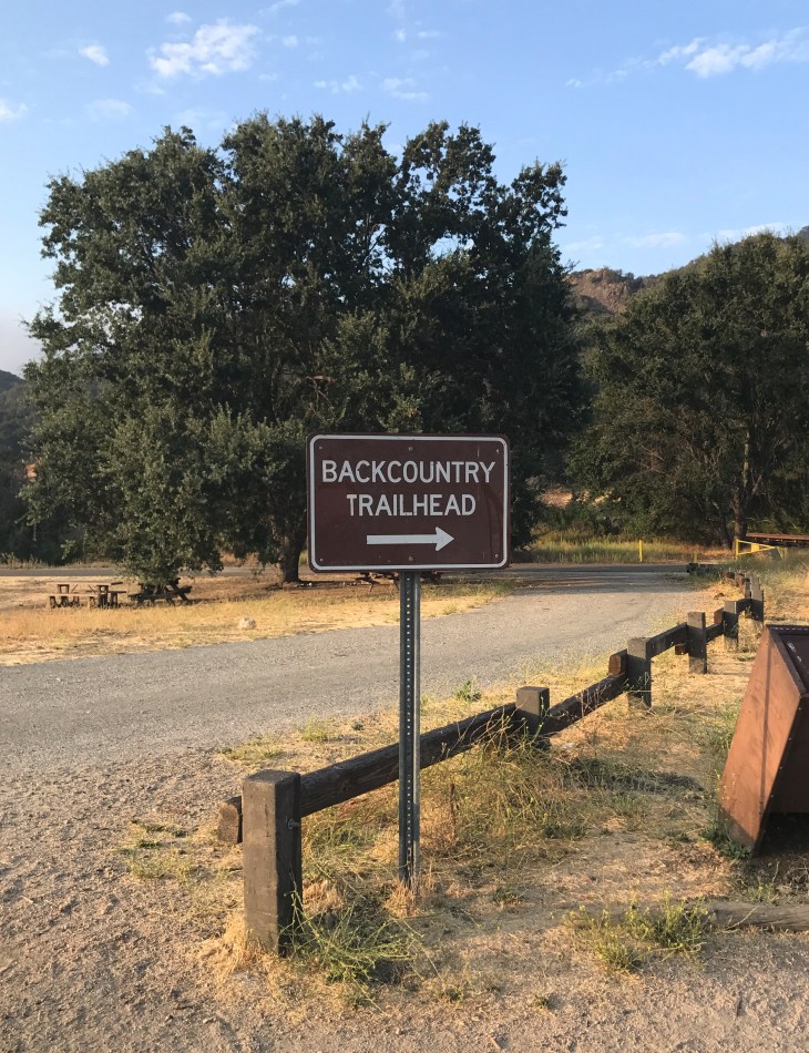
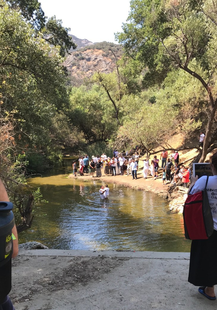
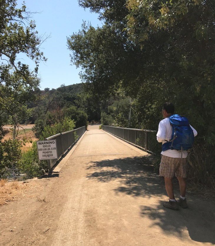
You will follow the trail, which is at this point paved, and very quickly come upon a bridge which crosses the Malibu Creek. The area is very well used on the weekends for swimming and picnicking. And every weekend, both Saturdays and Sundays, I have witnessed baptisms in the creek.
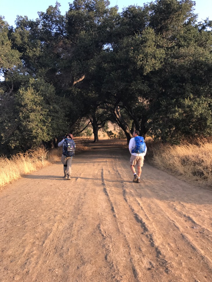
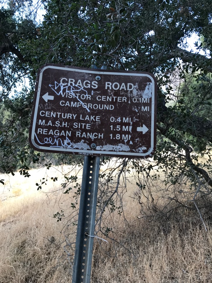
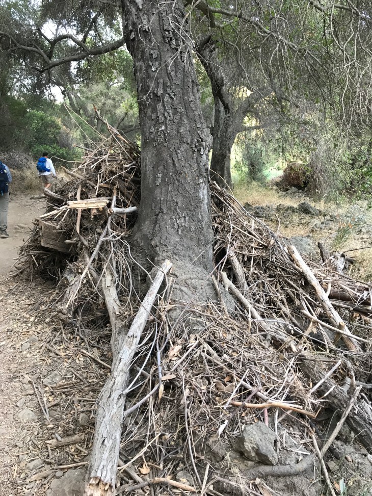
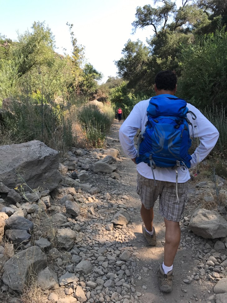
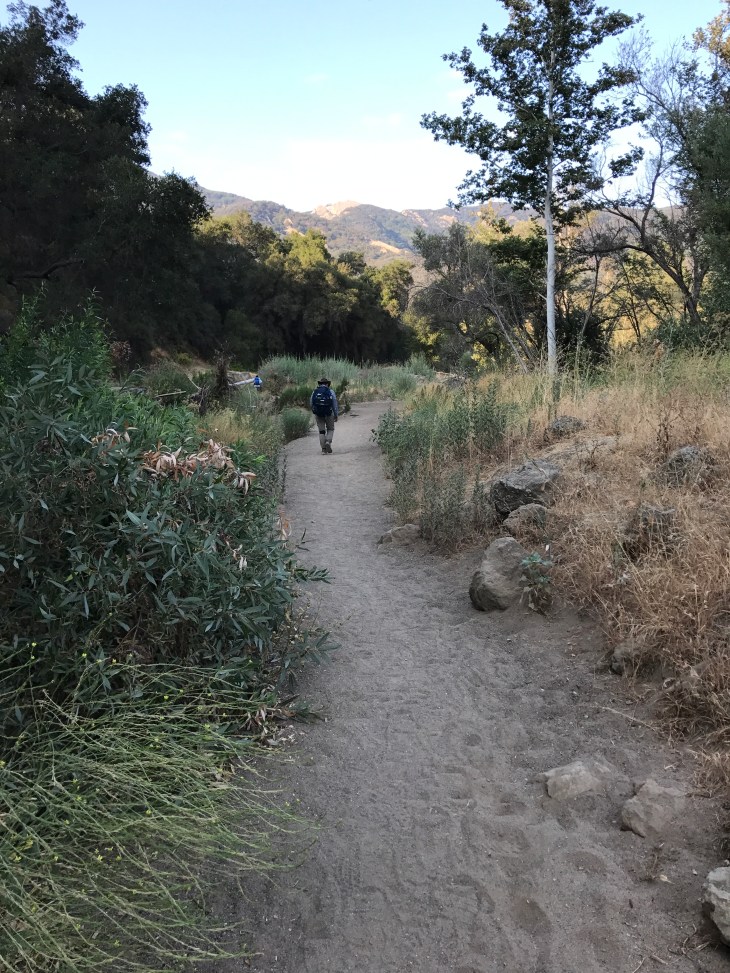
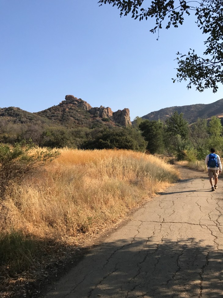
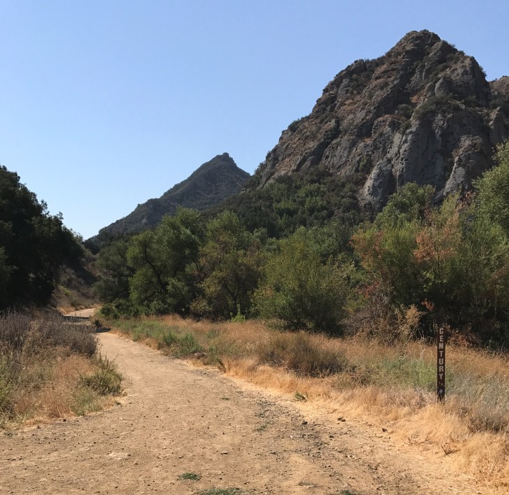
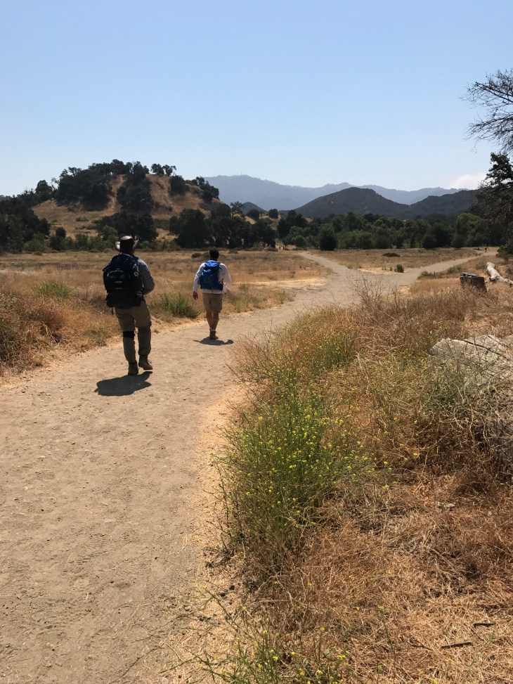
The paved road quickly becomes the fire road. There will be spotty shade along the fire road with beautiful old oak trees. The fire road travels along the creek bed. It was raging with water in December. It was almost totally dry on this hike in July. Continue along the fire road which leads to Crags Road.

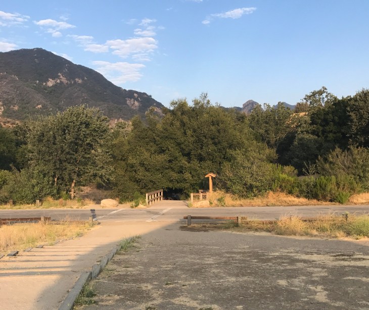
Continue along the fire road. The fire road begins to narrow down to a single-track trail. You often see deer or coyote on this part of the trail. You will soon find yourself on another bridge which crosses the Malibu Creek. The railings of the bridge were washed out by the creek during the heavy rains this winter.
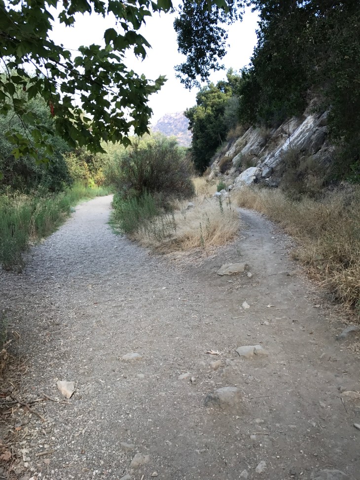
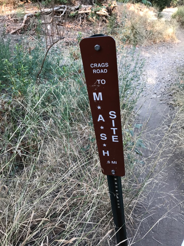
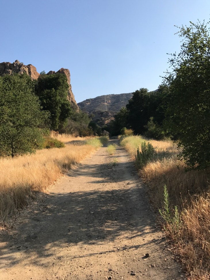
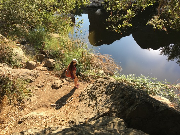
As you follow the single-track trail to the site the path becomes very rocky. You have lots of canopy cover here.

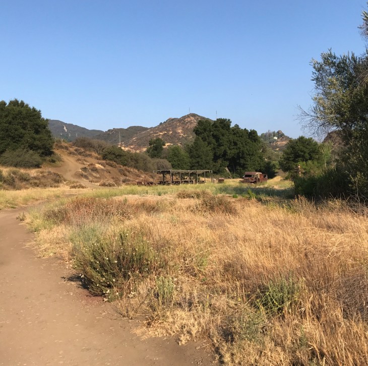
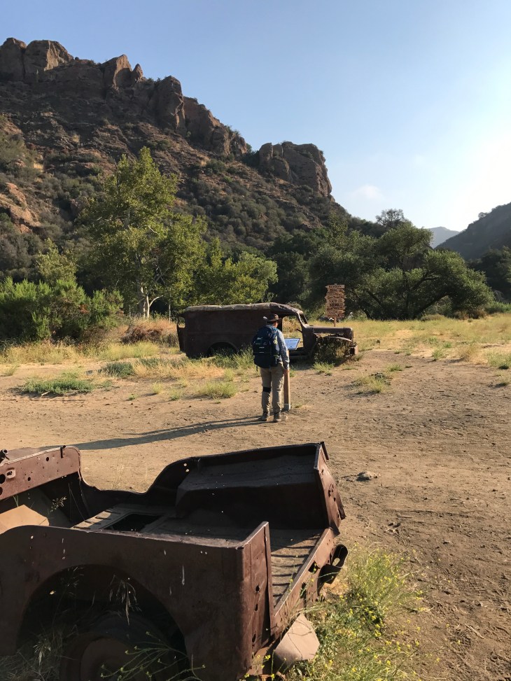
It is time to move beyond the site and continue along Crags Road. You will note that there is spotty pavement left over from the 70’s.
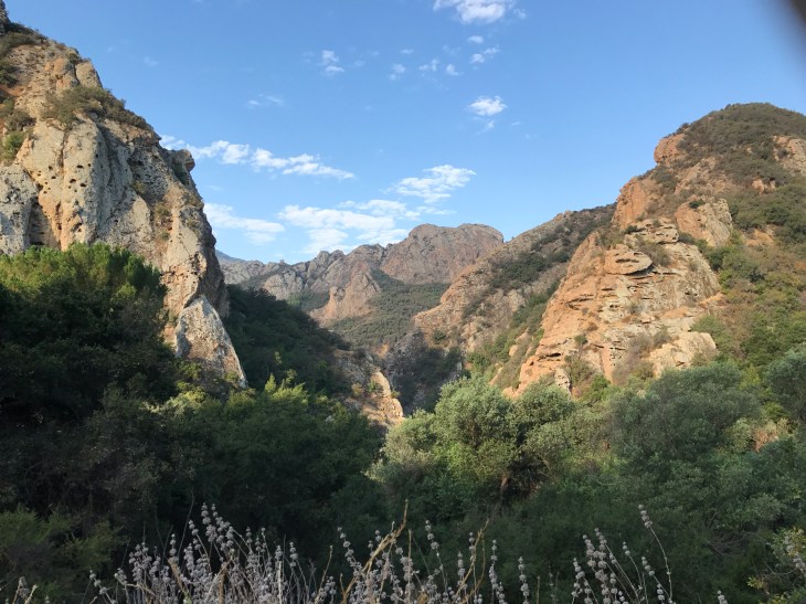
You can continue along Crags Road to the turn-around end-point of this hike. I’ve always enjoyed turning right on the road with the sign that says “Mal Dam”. It leads to the dam which is fenced off. There is a picnic table there and chairs for resting. There are beautiful rock formations on this road. And, most importantly, easy access to the water.
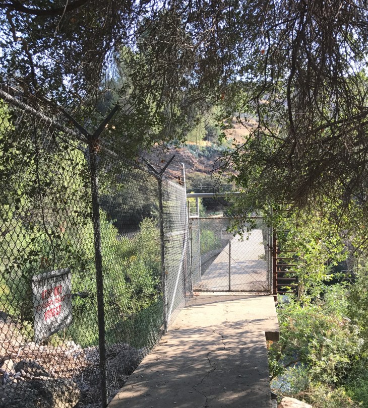
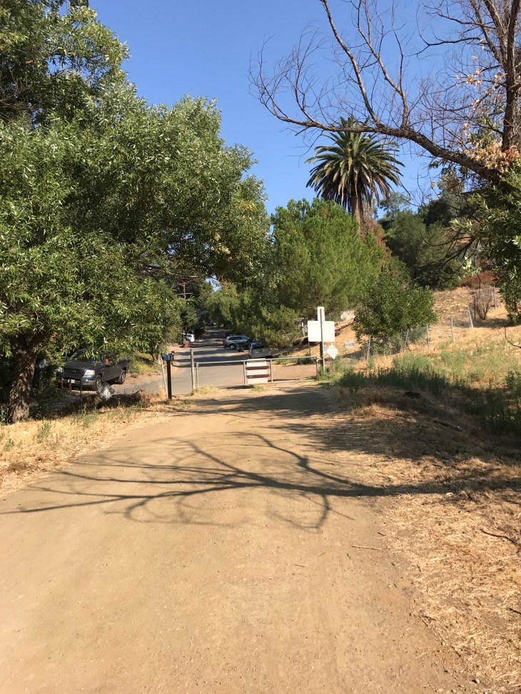
Go back to Crag’s Road and continue along. You will eventually come to a gate which separates the park from private residences. This is the 4 mile turn around point. You can continue another mile along paved roads to see Malibu Lake. We did. I’ve never seen it before so I took the opportunity to explore.
It is time to head back. You can make this an out and back hike and complete a nod-worthy 8 mile hike. I would like to show you some other options on the way back that you may want to check out.
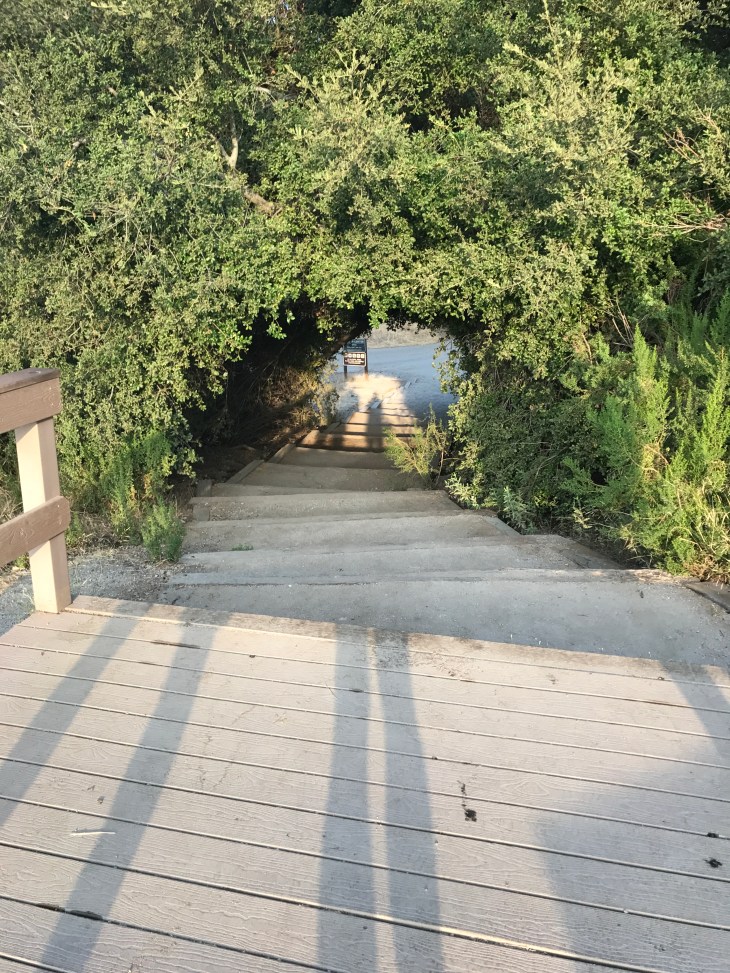
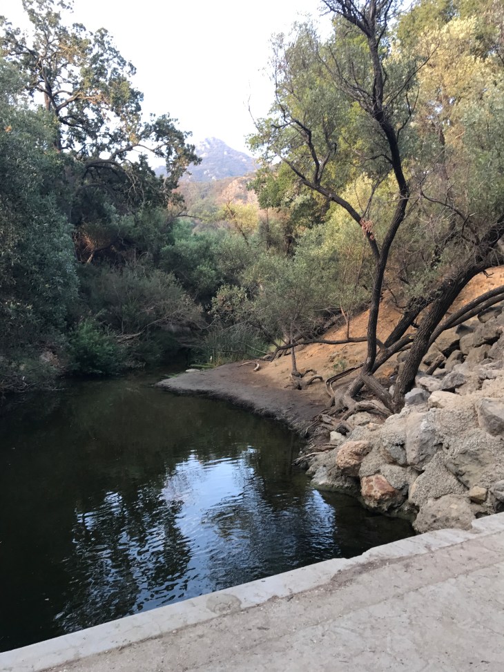
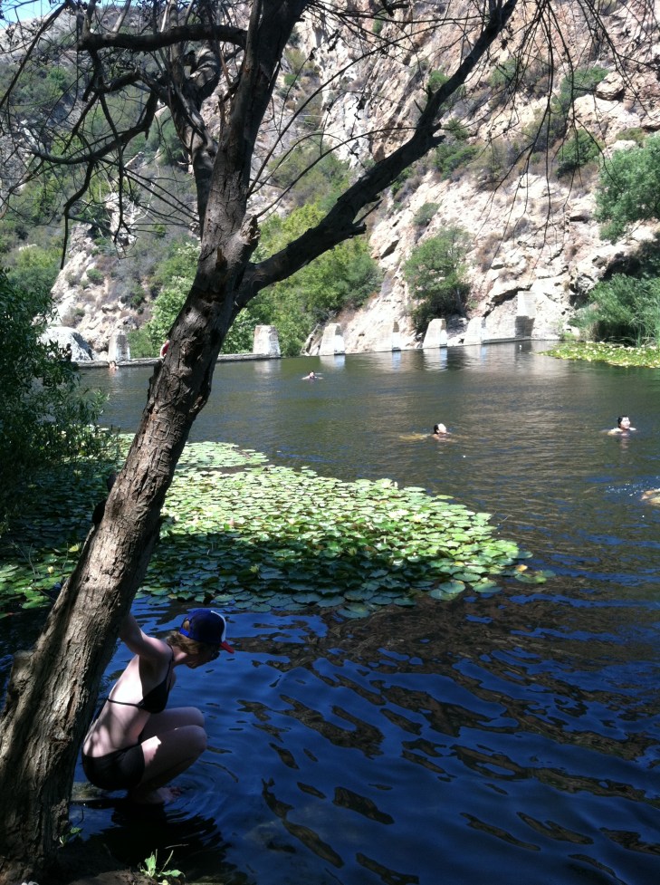
When you go past the M*A*S*H site and back over the washed-out bridge you will come upon the sign to Century Lake. My all time favorite spot on this hike. You can fish in the lake. You can swim in the lake. There is an immediate drop off in the water, there really is no shore to allow you to wade in. If you are not comfortable swimming, don’t swim here. In times of extreme drought, such as in the last two years, the water level drops dramatically and causes an increase in bacteria count. I do not recommend going in then.
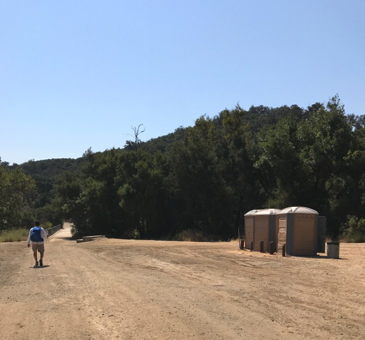
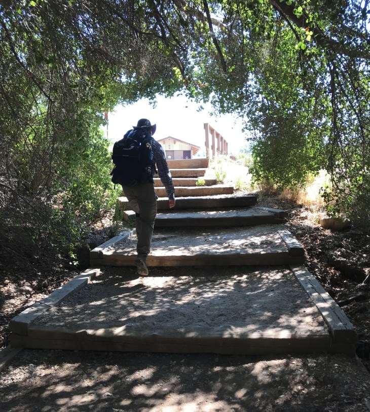
After you’ve dried yourself off, you can head back to the fireroad and continue on towards the park entrance. Once back on the fire road, you will see another turn off to the right. This leads to the Rock Pool and the visitor’s center. You know you have gone the right way when you see three incredibly stinky port-a-potties.
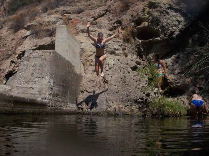
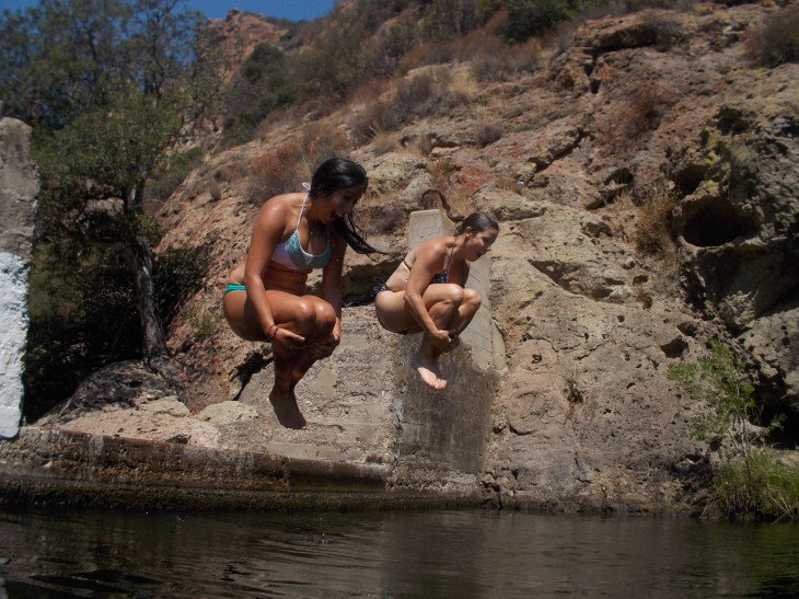
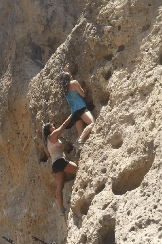
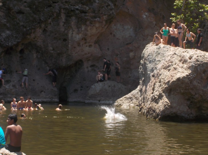
If you go off to the right of the port-a-potties you will eventually find your way to the Rock Pool. On the way down to the Rock Pool you will pass walls that are use for rock climbing, both free-style and with ropes. On any given weekend you will find hundreds of people at the Rock Pool. Many teens and young adults. There are several rocks/cliffs to jump from into the water. Waves of people are always coming in as I exit the park. Warning: I have spoken with several rangers who have told me that the bacteria count in the pool area is very, very high, especially when the water is low. This may be because of the number of people who use it, the number of babies in the water with diapers, and the relative slow movement of the water. I’ve never gone in again after being told that. But many hundreds of people do every weekend.
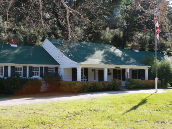
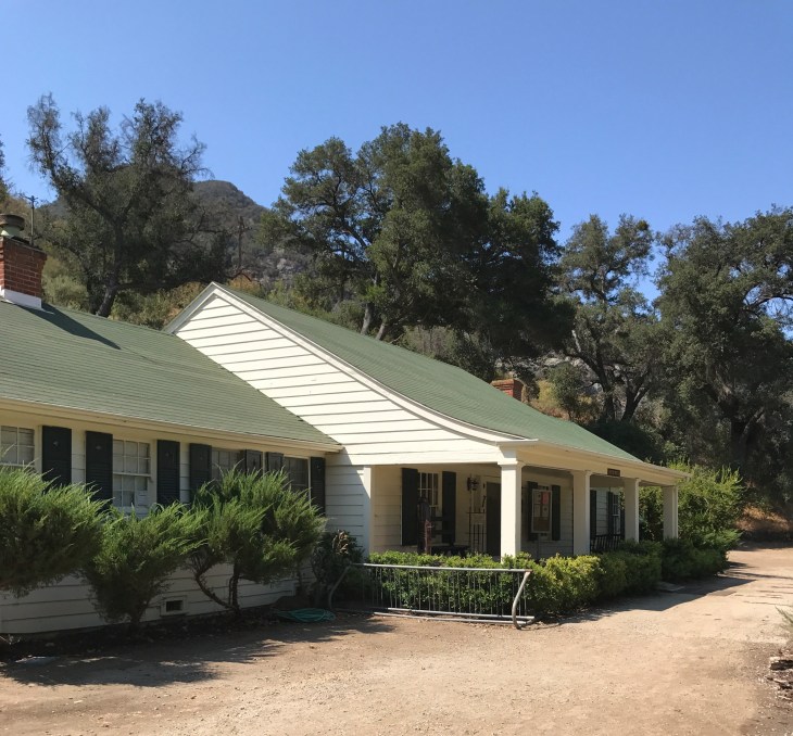
When you leave the Rock Pool you can head past the Port-a-Potties and over a bridge towards the visitor’s center. The center is worth the visit if you are there when it’s open. It is open on Saturday’s 12-3pm. There are several displays of Chumash artifacts, wildlife and local plants. Then head across the grass field when you leave to get back to the parking lot. This is where you will run into all of the people making there way to the Rock Pool.
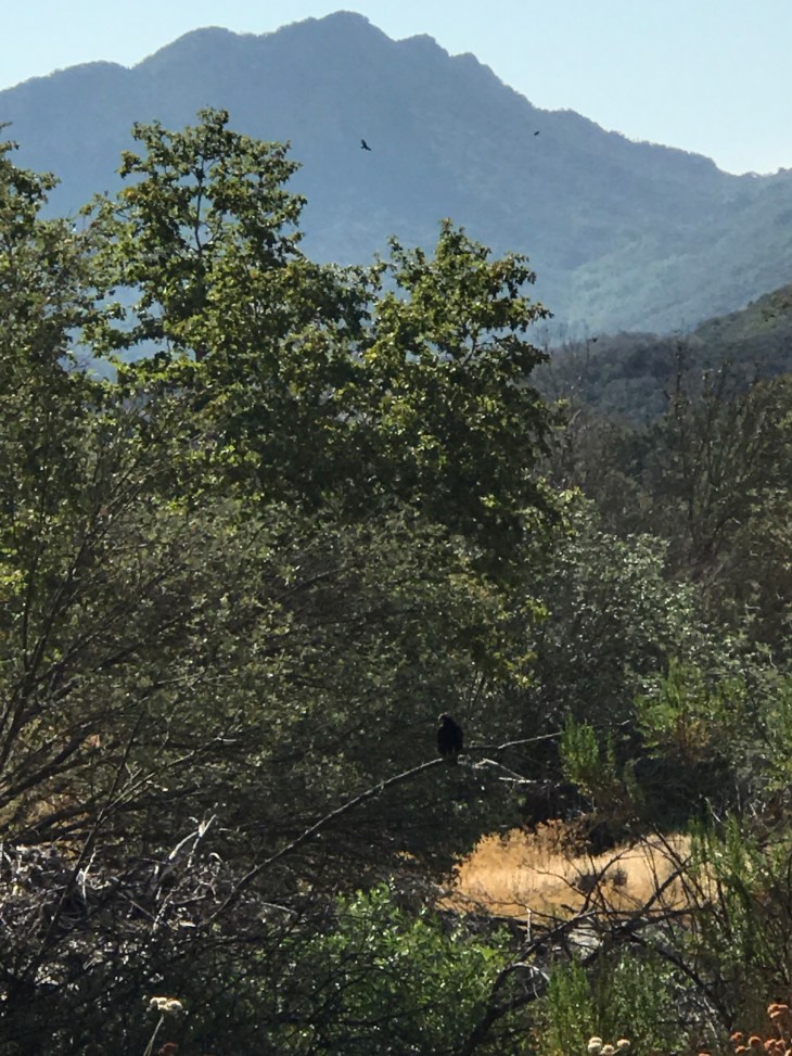
Malibu Creek State Park has something for everyone. Spend the day there and camp, picnic, hike, swim, climb, fish, bird watch, trail run or ride a bike. You will enjoy yourself immensely.
Next, we are off to a much more challenging hike. Topa Topa Bluff trail. She’s a doozey. She tough. She’s mean. She can be beaten, but only after she’s beaten you.