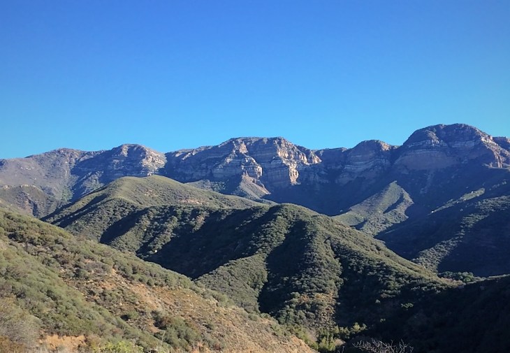
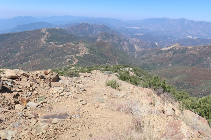
Topatopa Bluff trail is found in the Sespe Wilderness of the Los Padres National Forest. The beautiful multi-colored horizontal banding of her face can be seen from almost anywhere in western Ventura County. She is always there sitting quietly in the background. We’ve become so accustomed to her presence that over time that we tend not to notice her. But she is there waiting for you to come for a visit. She is patient. I encourage you to go for the experience. Though make no mistake, Topatopa is a task master, a bad mamma jamma. This is a strenuous hike in both distance and elevation gain. The distance is 16 to 18 miles depending on where you park and boasts of a nearly 5,000 foot elevation gain.
I began to write this blog about nine months ago and stopped. I think I was mad at Topa for being so darn hard. I find the hike both physically and mentally challenging. The trail goes up and up almost the entire way to the top. No rolling hills on this lady. To make matters worse, over the last mile, when you are physically at your limit, you have to trudge up the steepest part of the trail. During that final mile you gain more than a 1,100 feet of elevation. I try not to think about that while I’m on the trail. I mentally break this hike down into three distinct sections to make it more bearable. The fire road, the single track trail to White Ledge Camp and then Hell to the top. My husband John, our friend Garrett and I did this hike in August of 2017. It was my fourth trek to the top. I know that the hike can be done and that I will survive it. Just barely. It usually takes seven to nine hours to complete. On this day we started on Highway 150 at the entrance of Sisar Road which made our round trip just over 18 miles. So why do I continue to hike it? Well, because I think it is a great training hike for the higher summits in the Los Angeles and San Bernadino Mountain ranges. But also because when you are up there you realize how beautiful it is. On the top of Topatopa Bluff you will be rewarded with views of Ventura County that are hard to beat. And maybe, just a little, I feel pretty bad-ass for doing it.
History
What is in a Name?
What does Topatopa mean? Is it one word or two words? Topatopa vs Topa Topa. These questions weren’t as easy to answer as I thought. I am going to present what I found then you can decide.
One of the questions was easy to answer. Topatopa is a single word. There are multiple reputable sources that site this. However no one will be mad at you if you spell it Topa Topa, as many local businesses have. Where the word originated is universally agreed upon as well. The name Topatopa has its origin in the Chumash language. But how does it translate? Let’s see.
I believe the most reliable answer would come from someone who is most familiar with the Chumash culture and its language. Julie Tumamait-Stenslie addressed this in an article for Ojai History. Ms. Tumamait-Stenslie is a descendant of the Chumash and is sought after to share the folklore and history of her people. She writes “..we have to first acknowledge the great Topa Topas. The name comes from the Chumash word “sitop topo” which means much cane. This type of cane was used for arrows and for small tubes about 2 inches long used to hold tobacco and then the person would pierce it through the ear lobe.” (My Chumash Ancestral Legacy, 8/11/2011).

This seems to be confirmed by Alfred Louis Kroeber. Kroeber (1876-1960), founder of the Department of Anthropology at UC Berkley, was at one time thought of as the foremost authority on California Native Americans. In his book California Name Places of Indian Origins (1916), Kroeber writes that; “Topatopa is named after a rancheria of Chumash Indians near Ojai, given the name topotopow and si-top topo“, echoing Ms. Julie Tumamait-Stenslie’s definition.
It is also widely believed that Topatopa is derived from the Chumash word for gopher: topa. Craig R. Carey (The Case of Too Many Topas, 11/5/2010) posted the following story: “legend has it that long before the Spanish arrived, what is now known as the Ojai Valley suffered a period of drought, and the village prayed and danced for the rains to to come. One day, two snow-white gophers appeared in the village, and the heavens opened, relieving the drought. The gophers, cared for by the villagers, were later buried along the ridge now bearing their name.”

The debate goes on. On the Sierra Club Hundred Peaks Section Website I found the following: The name is first implied in the Archives of Mission San Buenaventura (ca. 1943), citing a nearby Indian rancheria named Si-toptopo. J. P. Harrington of the Smithsonian Institution notes that topa is a Chumash Indian word meaning “reed” or “rush”. Alternatively, based on an old local story retold by William S. Brown in his History of the Los Padres (1945), the word referred to gophers, “and to emphasize the numbers of this burrowing animal existing there, the word was repeated“. Harrington rejects all of these suggestions since to the Chumash “mole” is tapo, not “topo”.
Well then. Just for fun click here to watch a YouTube video which tries to explain it all.
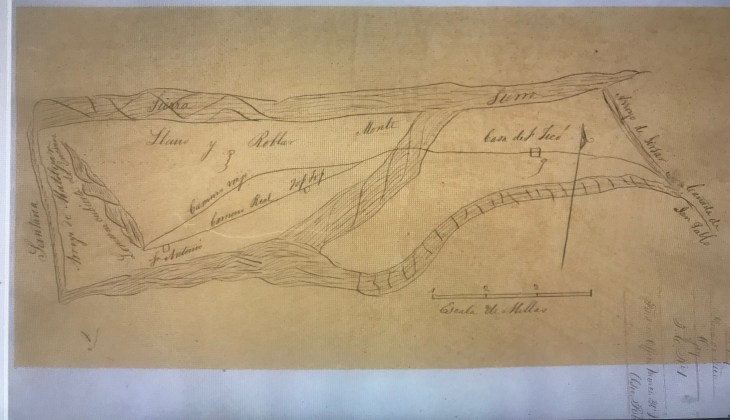
I was not able to find many historical documents related to Topatopa. Below I’ve included two that I discovered in my search. A diseño is a rough map required to be submitted with Spanish and Mexican land grant petitions made in Alta California before the Mexican-American War. The following diseño from 1840 is of the area surrounding Sisar Canyon (noted as Arroyo de Sisar on the right of this map) and is inscribed with Top Top (center-left) to indicate Topatopa bluff.
The Chumash Native Americans lived in Sisar Canyon thousands of years before Europeans came to the area. I found an interesting account related to this on the Ojai History website. The site printed a memoir by Lowell Mason Hardison which had been donated to the Ojai Valley Museum. Hardison was an early settler in the Upper Ojai Valley.
“About halfway up the Sisar Canyon, well up on the side, I discovered an old road that, by its width, must have been used as a wagon road. It was several hundred feet in length and covered with a heavy growth of brush. I thought that it must lead to one of those lost mines. I searched for several days to find the beginning or the end of the road without success. I learned later that some of the timbers used in building the old Mission at Ventura were brought down this canyon. On the west side near the mouth, I found an old camping ground, or should I say a picnic ground, for by the shells that I uncovered, it must have been a meeting place for a clambake. Some of the shells were very old, no doubt, but the creek ran much higher on the bank than it does now, and flowed through the Ojai Valley. We have the old channels of creeks as evidence. In blasting out a large boulder, I found underneath a fine mortar-pestle, which I think you will find in the archives of this Society. On the Gibson and Bracking places, evidence of large Indian campgrounds could be traced; many stone implements were uncovered in plowing the fields. In the side of the bank of an old creek bed, on land that I once owned, was a cave high enough for a man to stand up in, and large enough to house quite a family. I think the occupants must have left in a hurry and had no time to remove their household furniture, as all was broken.”

The trail to the Topatopa Bluff that we hike today was developed in the early twentieth century. The work has been attributed to Ranger George Bald. George Bald came to the Ojai Valley in 1886. His first job was working for Edward Thatcher on a ranch which is now known as Topa Topa Ranch. Around 1902 Bald became a forest ranger in a station that was based in Nordhoff (Ojai). He worked a large territory including: the Ojai Valley, Sespe Hot Springs, Mutah, and Sespe Gorge to the Lockwood Valley. For two decades his crews carved out trails in these areas. Three trails that he helped to blaze were the Topa Topa Trail, the Ocean View Trail and the Pratt Trail.

Statistics
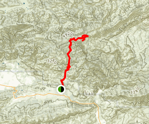
Type of Route: Out and Back
Distance: 16-18 miles
Elevation: 6276
Elevation Gain: 4,825 feet
Time: 7-10 hours
Difficulty: Moderate to Strenuous
Dogs Permitted: Yes, On leash
Permit: None
The Hike
The Topatopa Bluff trail head is located off of highway 150 at the end of Sisar Road. Sisar Road is located in the tiny town of Summit. Summit, and more specifically Sisar Road, is said to be on the dividing line between Santa Paula and Ojai. Highway 150 is a windy two-lane road with beautiful vistas of the mountains and valleys. If you are heading north from Santa Paula, you will find Sisar road tucked between the Stage Coach Market and an elementary school. Keep an eye out for the market. It’s very easy to miss the turn onto Sisar Road.


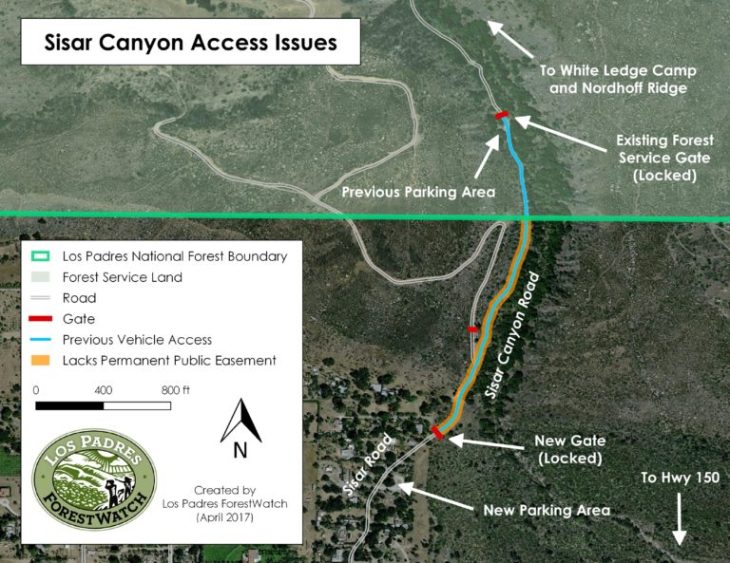
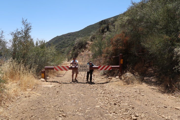
In March, 2017 the private landowner of over 100 acres along Sisar Canyon Road built a locked gate to permanently restrict vehicle access to Sisar Canyon. For years the public had been allowed to drive up the road to the Forest Service gate and parking area. Those on foot and horse back still have access to the trail in an opening built between the gate and fence. As you turn from Highway 150 and travel along the very narrow Sisar Road you will find a small parking area near the gate which may fit 5-6 vehicles. If that lot is full, you can park on the side of Highway 150. The hike from highway 150 to the gate adds an additional mile to the top. Remember, be respectful of the residents as you are driving or hiking through this quaint, quiet neighborhood.

As you get started on this hike know this; It is a very long hike with lots of elevation gain. Make sure that you have adequate water and nutrition. I would recommend three or more liters in the summer time.
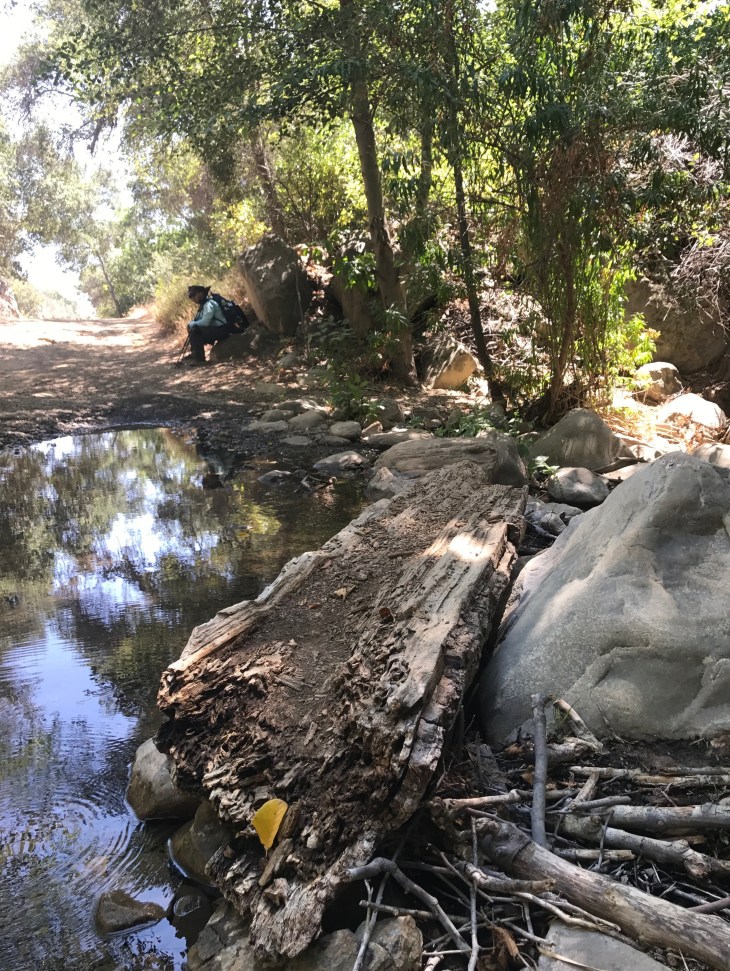
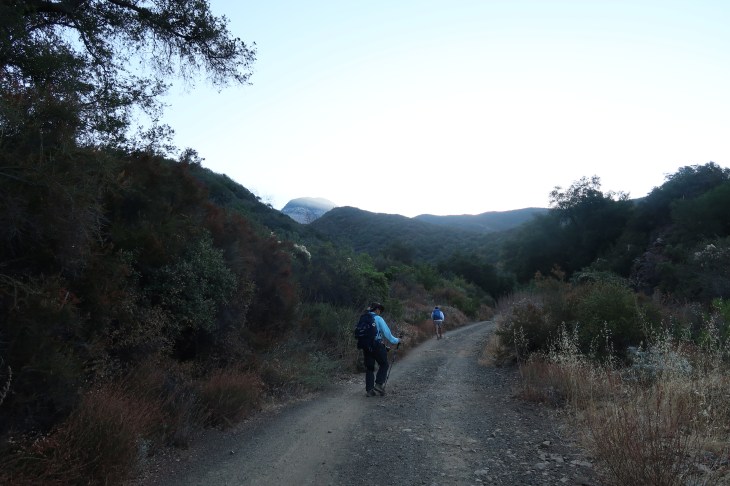
Once you pass through the Forest Service gate you will begin walking up a fire service road (beginning elevation 1800 ft). In about a quarter mile you will quickly come to the first creek crossing. There is usually water there in the winter and early spring. It is dry in the summer though when we went through in August this past year there was still water. Even when full with water the creek bed is not a challenge to cross. Hiking poles come in handy when you are working your way across on the rocks.
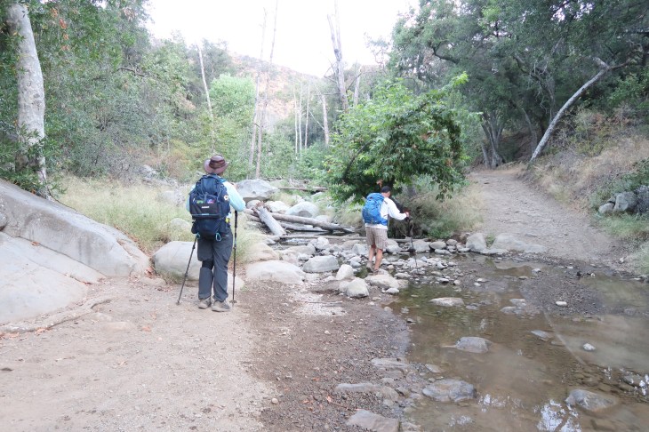
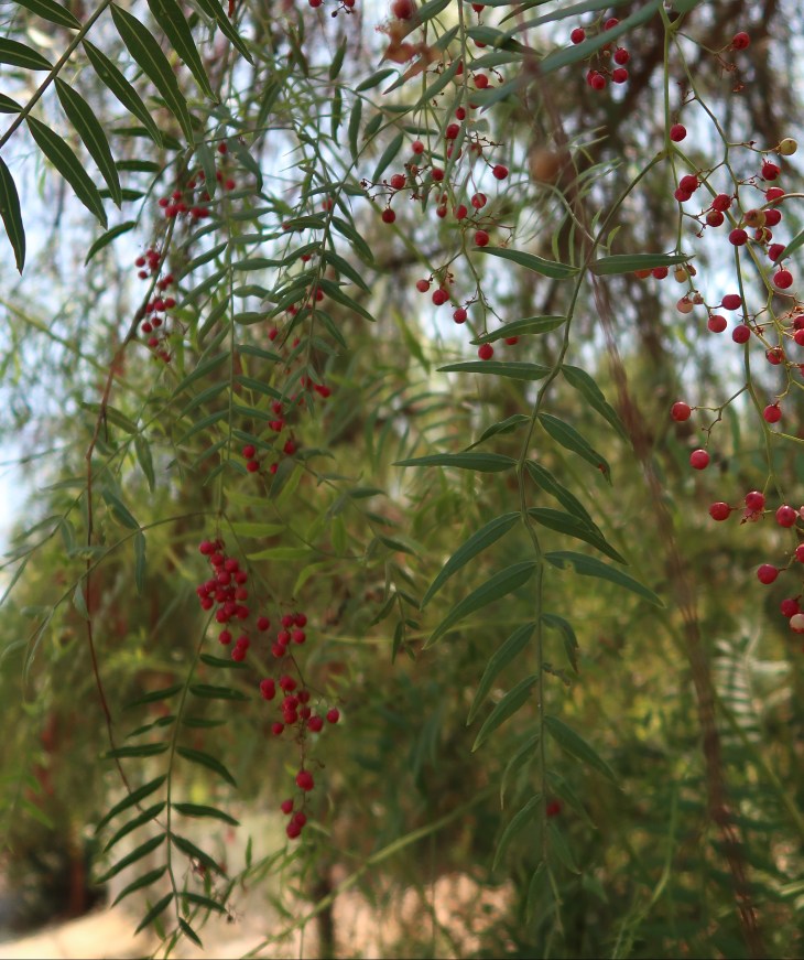
You continue steadily uphill for a mile and will cross the creek a second time. As you are walking in this area you will enjoy the sounds of the babbling creek. You will walk through an oak grove and see ferns lining the canyon walls in the shade of the oak trees.
As you approach the second creek crossing you move away from the oak trees on towards the more fragrant Bay Laurel trees.
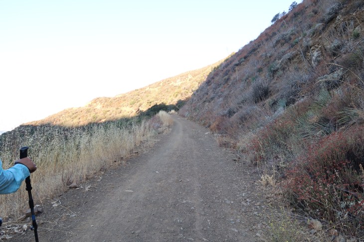
You will continue up this fire road. The road continues to gain moderate elevation and has many turns. About one third of a mile beyond the second creek crossing, on right, you will find a bench to rest on.
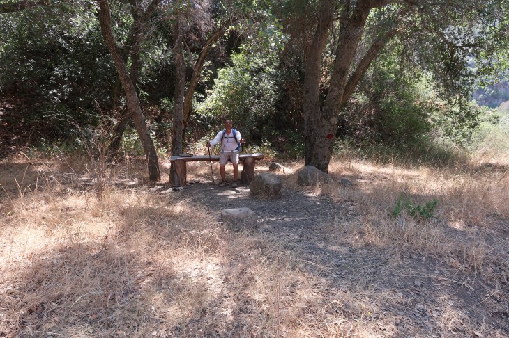
A moment to rest and a quick photo op before heading up again.

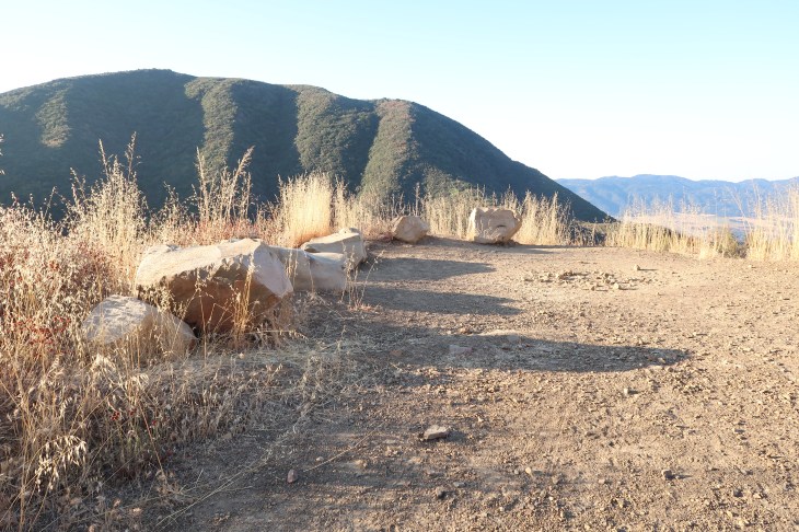
Just beyond the bench you will come to a cross roads. Stay to the left. The gated property to the right is part of the Howell Place and not the trail.
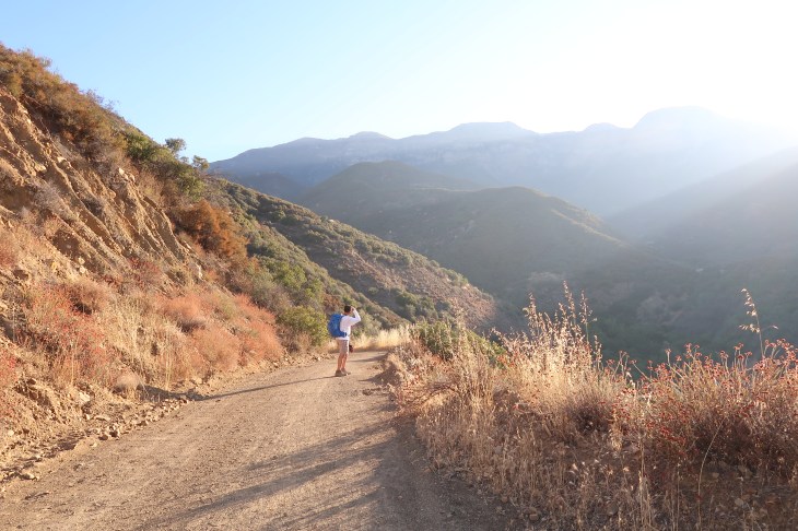
A sneak peak of Topatopa on the way up the fire road. At this point, you will be turning left away from the creek. This is my favorite part of the trail to take first timers. When you get to the top of this rise and turn around, you are treated to a lovely views all around and the most spectacular view of Topatopa. It’s beauty takes your breathe away.
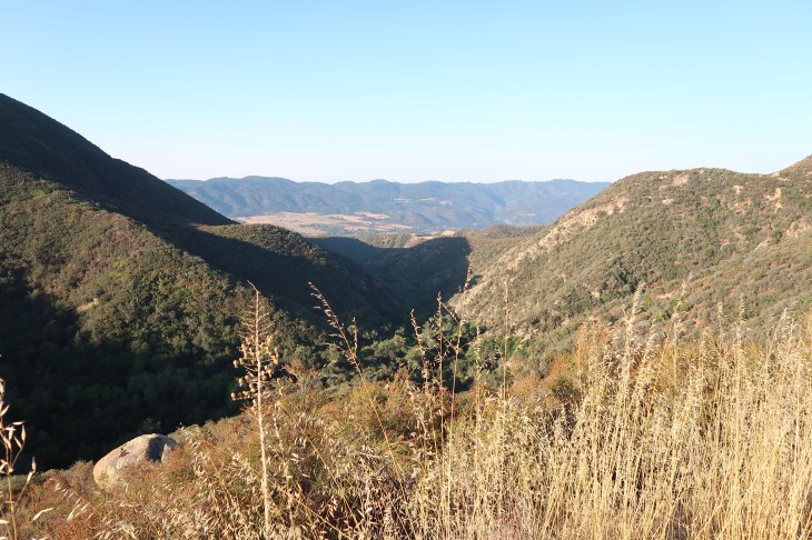
There are boulders at the Overlook that invite you to sit, rest, and enjoy the beauty of your surroundings.
One of my favorite memories on this trail happened at this corner, the Overlook on Sisar Canyon trail. My best friend Lori and I had just made it to the Overlook. We had been passed earlier by four teenagers running up the trail. No small feat. They were on the high school cross country team and they were getting an early morning work out in. They had never been to the Outlook before and were struck by the beauty of its vistas. Just off the trail there is a large rock that one of the boys climbed up on. Like any young explorer he was very excited about his discovery of the rock. He christened it “Lonely Rock” because it had fallen away from its comrades higher on the trail. As if he were the first person to find and climb it. If he had a flag I’m sure he would have planted it! My friend and I were caught up in the young group’s enthusiasm, saluted them and Lonely Rock, and left with smiles on our faces. This is the wonder and the magic of hiking.
You will continue up the fire road for another half mile or so until you come to a Forest Service gate. You are now just over three miles from the trail head (four miles from Hwy 150) and at 3,280 feet in elevation.

This is the junction of the fire road and Red Reef Trail. The fire road will continue up to the left. You may see mountain bikers here ringing their bells as they dash madly down the hill. To the right is the Red Reef trail. Is is a single track narrow trail and feels much different than the fire road. For the first time you will have canopy cover and not the full exposure to the sun. Which reminds me to tell you again, It gets incredibly hot, dusty and dry here in the summer. Bring lots and lots of water.

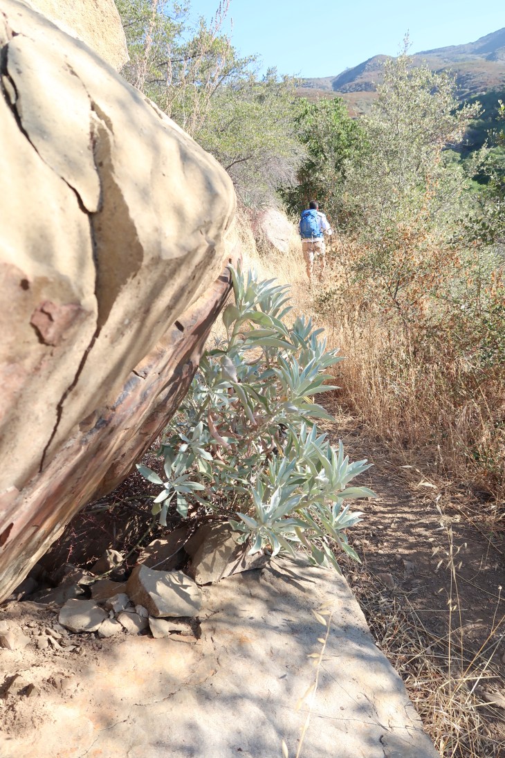
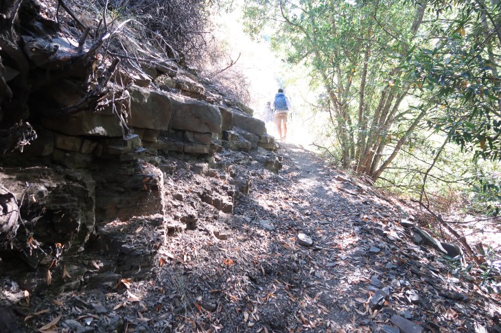
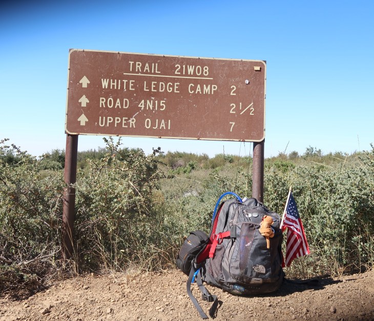
The Red Reef Trail is sometimes overgrown and there are sections where parts of the trail have eroded. The trail at times becomes very narrow. Please be careful as you hike along this trail. There is a geocache on this section of the trail for those of you that look for them. Follow the Red Reef trail for about 1-1/2 miles and you will find yourself at the White Ledge Camp (3,880 ft elevation).
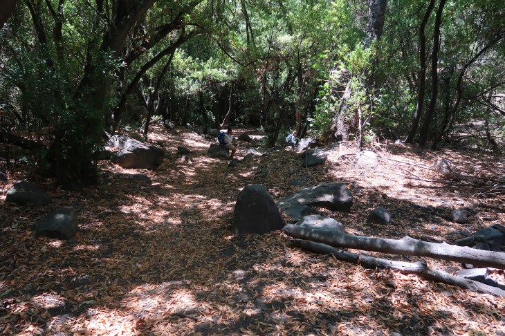
White ledge is a good spot to rest before heading up to the top. The creek runs along the campground to the right and is a nice place to set up hammocks. I’ve done that twice when the goal was to get to White Ledge and not the top of the bluff. Getting to White Ledge will be a ten mile round trip hike. Not shabby. White Ledge has a fire pit, shovel and pick available for campers. During my first hike to White Ledge I met two young ladies sitting around the fire pit enjoying a nice bottle of red wine to celebrate making it to the campgrounds. They introduced me to the the AllTrails app and I am forever grateful for that. That $1.99 investment has kept me from becoming completely lost on several new trails. There is no better way to learn stuff about hiking than talking to folks on the trail.
It is lovely at White Ledge and so quiet. Except in the summer time that is, when gnats and mosquitos are buzzing around your head. That being said, most of my visits to the campground have been bug-free. Once you leave the shelter at White Ledge you head north up Red Reef trail. The trail becomes very steep at this point. My first hike out of White Ledge is to this day one of the scariest moments I’ve had on the trail. I went up first ahead of my group and I suddenly heard this very loud crashing noise coming through the trail. I knew that it was not a lizard and it was not a bird. It had to be HUGE. In those brief seconds I was one hundred percent sure I had a bear charging down on me. And yes, there are bears in them there hills! I was frozen in place, wondering how it was possible that the only time all day I’ve been in front was when a bear was coming straight at us, as a kid on a mountain bike came crashing down into the campgrounds. It took a very long time for my heart rate to come down as I head back up the trail.
Initially you will have some cover but that quickly gives way to dirt and low manzanita brush. And sun exposure. And elevation gain. NOT my favorite part of this hike.

There is very obviously no cover from the sun on this part of the trail. In the summer it is brutal. Beginning the hike early helps you beat the greatest heat of the day. Wear a hat and use your sunscreen. And hydrate.

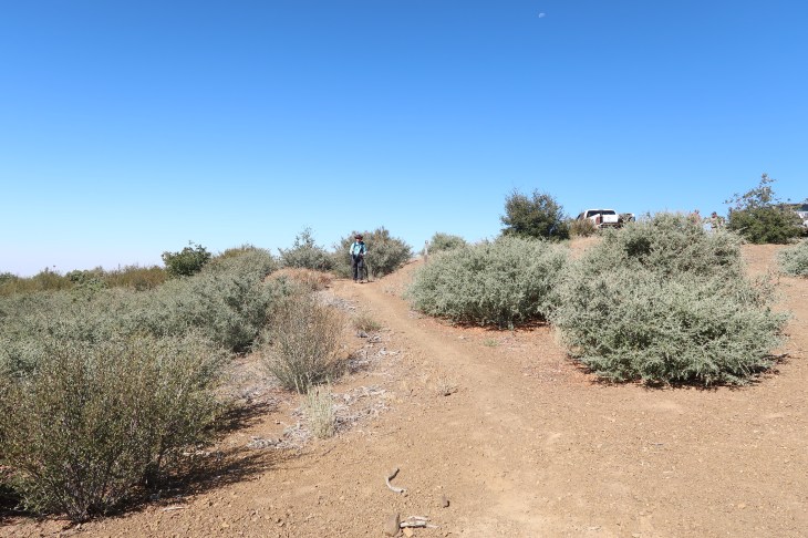
After two miles of this nonsense you will come to the junction of the Nordoff Ridge fire road (5,230 ft elevation). You turn right at the fire road and head towards the Trail sign.
You will continue beyond the sign uphill towards Elder Camp (5,260ft).
You continue south towards the Topatopa Bluff trail. There was a sign once that marked this as the Last Chance Trail. It is also know as the Don Borad route. Don Borad was a volunteer from Santa Paula who lead the construction of this trail after the Day Fire in 2006.

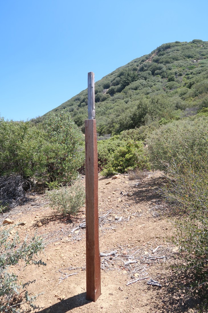

Beyond this sign you are headed to some fairly steep switch backs to get to the top of the bluff. I read that this sign suffered some damage from bears. Ok, but what did the bear do with the rest of the sign? And how did it do it so neatly? Onward and upward.
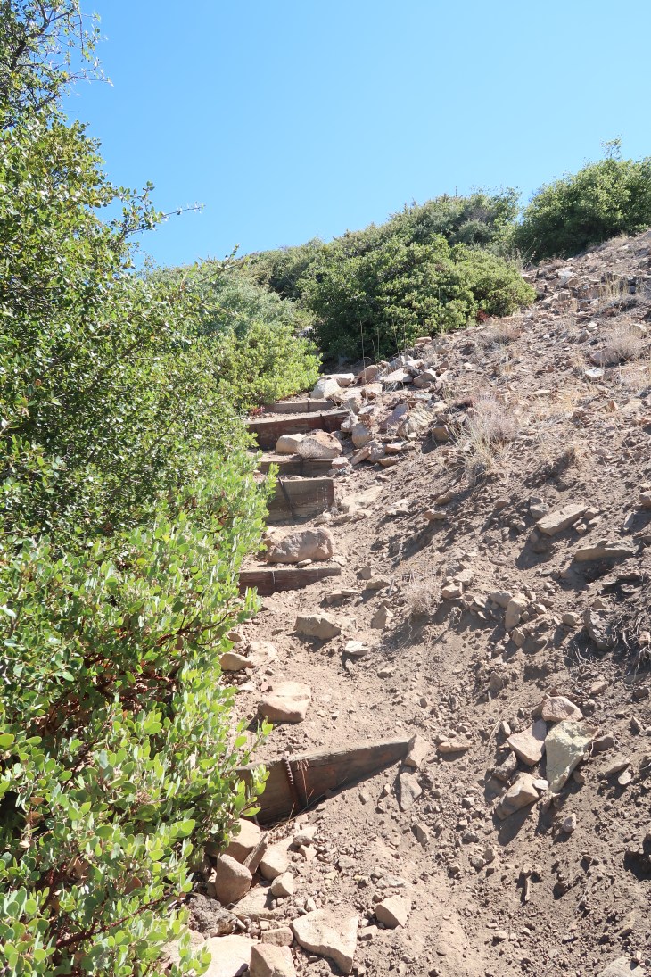
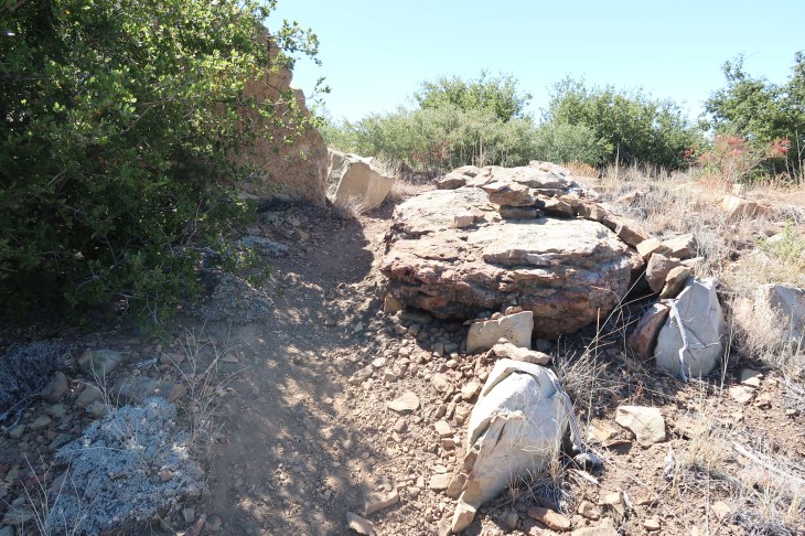
Up the right side of the hill there is a large section of fallen rock and shale and ruts from rain run off. This is not the trail though it is apparent that many people go this way. It is steep and dangerous and NOT THE TRAIL. Stay on the trail. The trail veers to switchbacks to the left. Be careful as you approach the steep wash out at the ends of the switchbacks the rocks are loose and slippery. The switchbacks can sometime be hidden by brush but you will find them.
It may not seem like it, but eventually you will make it to the top and be gifted with some spectacular views.

You have now reached the top of the Topatopa bluff at 6,370 ft elevation. You have just ascended 1,110 feet in less than a mile. Stop, look around and catch your breath.

At the top there are stone benches and a trail registry. The photo above is one of my favorites. It was taken a few years ago on my first summit on Topatopa Bluff in 2015. I was exhausted. I took a quick nap before heading down.

Garrett resting at the top.

Photo documentation of my photo documentation!
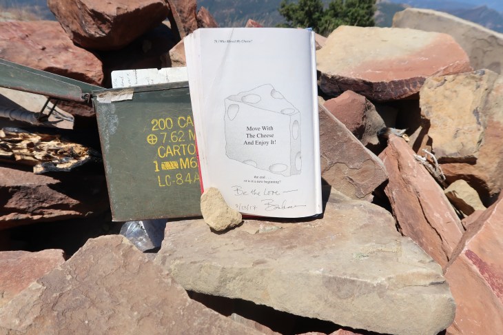
My entry in the registry. There was a regular notebook to write in but I chose the storybook. Because the book was about cheese and there is nothing not to love about cheese.
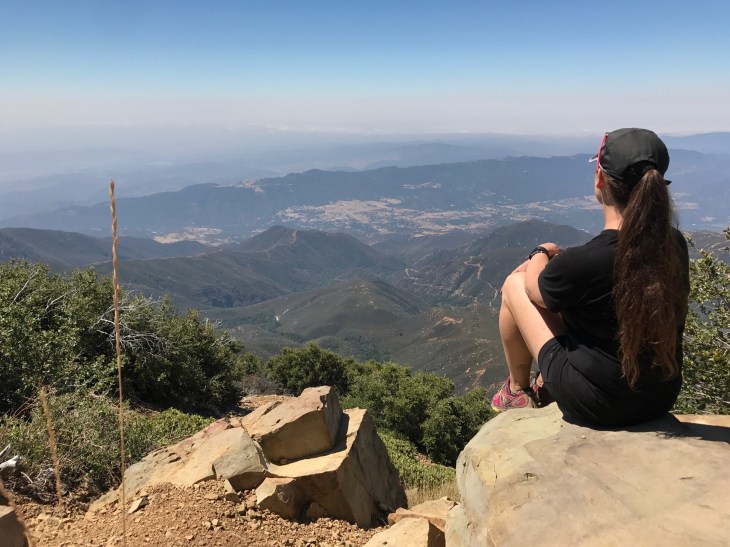
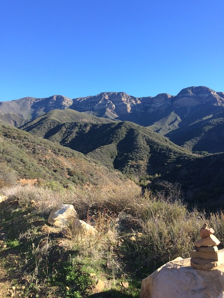
Looking out towards the Channel Islands and below, looking back from where we came.
And now to get back down. It’s interesting to me how people think going down is easy. I don’t find it easy. It’s hard on the feet and knees and you are tired and just want to get down and off the trail. So it is with some reluctance that I leave the summit. There are some rewards on the way down. You really can’t beat the view. And at the end, when you stumble back to your car, right there, on Hwy 150 is Summit Burger.


The Summit Burger is very busy every time we go there. There are the motorcyclists, bicyclists and the hikers getting some pretty amazing food there. The burgers are fatty and juicy and what you really want when you have a burger. The onion rings are pretty darn good too.

So there you have it. Topatopa through my eyes. I truly hope that you some day have the opportunity to do all or part of the trail. For now, I’m off for more adventure.
-Barbara
