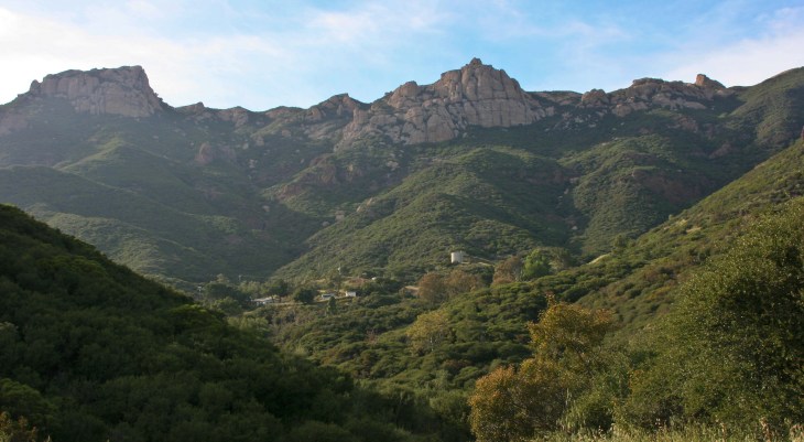
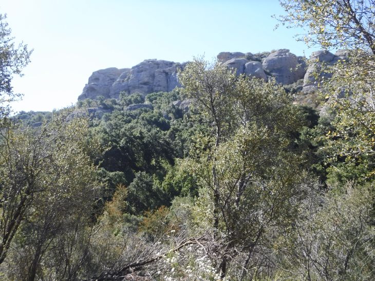
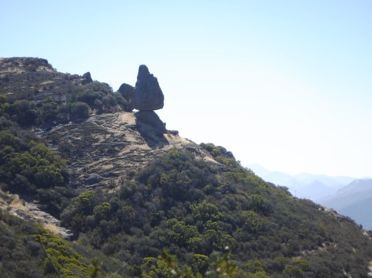
Eventually, as you work your way up the winding Yerba Buena Road, you will turn a tight corner and, quite suddenly, a view of Sandstone Peak and its surrounding rock formations come into view. Every time, without fail, I catch my breath at the raw beauty of this place. As I have said to many of my hiking buddies, pictures cannot do this view justice. You will just have to make the trip yourself. I have hiked to Sandstone Peak many times, in all seasons, and each time it’s a pleasure. There are several ways to do this hike. Many hikers will go to the peak and back to the parking lot for a total of 3 miles. Most choose to do the 6 mile loop. I do this hike clockwise though most websites recommend counterclockwise. I will present the pluses and minuses of going either way as I continue my discussion about this hike. No matter which route you take, or which direction you choose to go, you will not be disappointed.
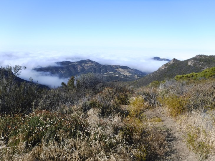
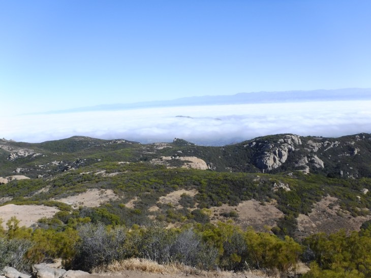
The Sandstone Peak is located in Ventura County, California and is the highest peak in the Santa Monica Mountains. When you reach the peak, you will be treated to 360° panoramic views of the Pacific Ocean, Malibu, Santa Monica, the Channel Islands and the Conejo Valley.
History
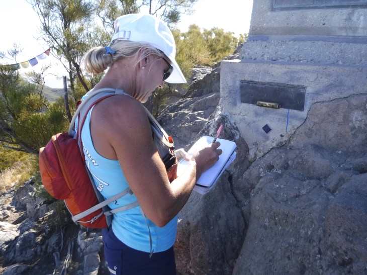
I must say that it was much harder to find history on Sandstone Peak than I anticipated. The best information I found was from a December 7, 1998 article from the Los Angeles Times. The area around Circle X ranch, where Sandstone Peak is located, was at one time owned by W. Herbert Allen. In 1956, Mr. Allen very generously donated the land to the Boy Scouts of America. The Boy Scouts took possession and named the area Camp Circle X. I could not find reliable information on Mr. W. Herbert Allen. I do know that at one time he served as president of the Los Angeles Area Council for the Boy Scouts. From 1956, the Boy Scouts of America began calling Sandstone Peak Mt. Allen. In 1965, the Boy Scouts of America petitioned the U.S. Board on Geographic Names to formally change the name of Sandstone Peak to Mt. Allen. This request was denied because the board has a long-standing policy to not approve geographic names to commemorate someone who is still living. The Boy Scouts had other ideas. A plaque, presented by the Exchange Club of Los Angeles, was placed on the summit of Sandstone to commemorate Allen’s gift, naming the mountain Mt. Allen. The plaque remains there still. There is a registry below the plaque where hikers leave messages and momentos. No one knows when this tradition started but there are registries in storage dating from 1966.
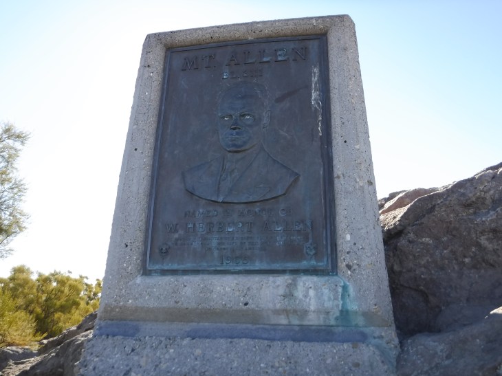
The Boy Scouts of America owned Mt. Allen and the surrounding area for four decades. In 1987 the Santa Mountains Conservancy purchased the property from the Boy Scouts of America for $5.85 million. The property is now managed by the Santa Monica Mountains National Recreation Area. In 1987 the area was renamed Circle X Ranch and the mountain was again called Sandstone Peak.
Fun Facts
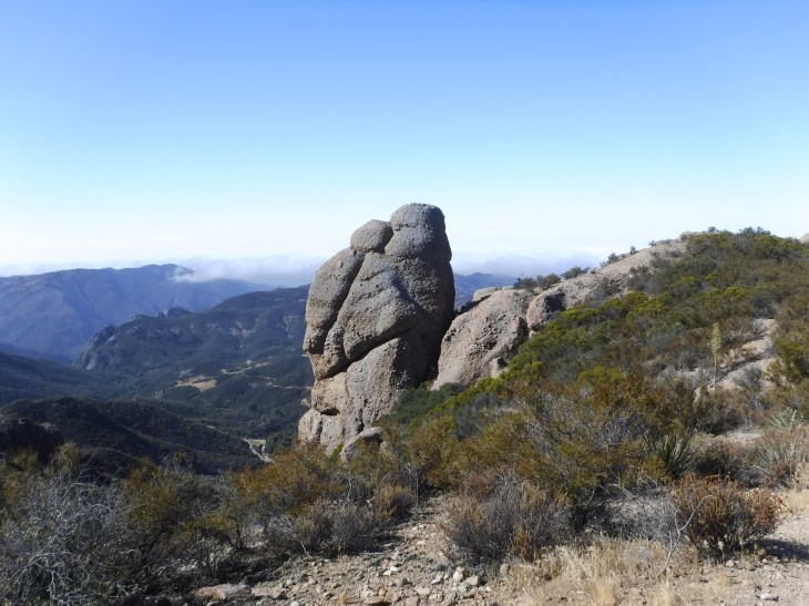
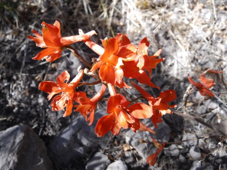
Sandstone Peak is not made up of sandstone at all! Sandstone Peak is made of igneous rock created by the eruption of a volcano. Igneous rock, I’ve just learned, is formed through the cooling and solidification of magma or lava. About 15 million years ago the volcanoes began to erupt explosively in the area creating the Santa Monica Mountains and the Channel Islands. For 3 million years the mountains continued to grow to over 10,000 feet in height. I don’t know how they know this. I will trust that this is true. This is approximately three times taller than they are today. Sandstone Peak itself is in the Conejo Volcanics Formation. Over the last 13 million years erosion has left the Sandstone Peak a mere 3,111 feet.
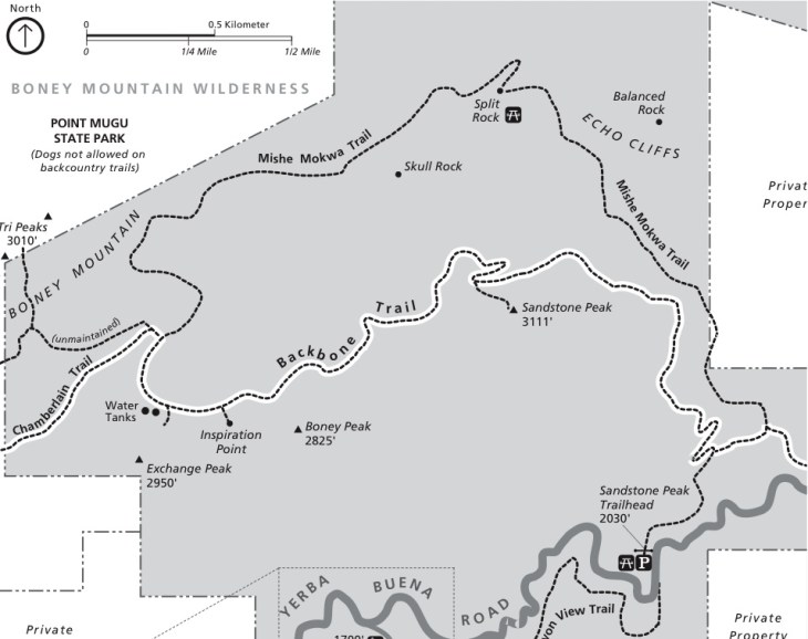
The Hike Statistics
Type of Route: Out and Back or Loop
Distance: 5.8 miles
Peak Elevation: 3,111 feet
Elevation Gain: 1,607 feet
Time: 2-4 hours
Difficulty: Moderate
Dogs Allowed: Yes, on leash
Permit: None Needed
You can hike the trail Summer, Winter, Spring and Fall. It can be extremely hot and dry in the summer with very little protective shade. Bring plenty of water, electrolyte replacement fluids, hat, suncreen/block and snacks. Start hiking early in the morning during the summer to avoid the heat.
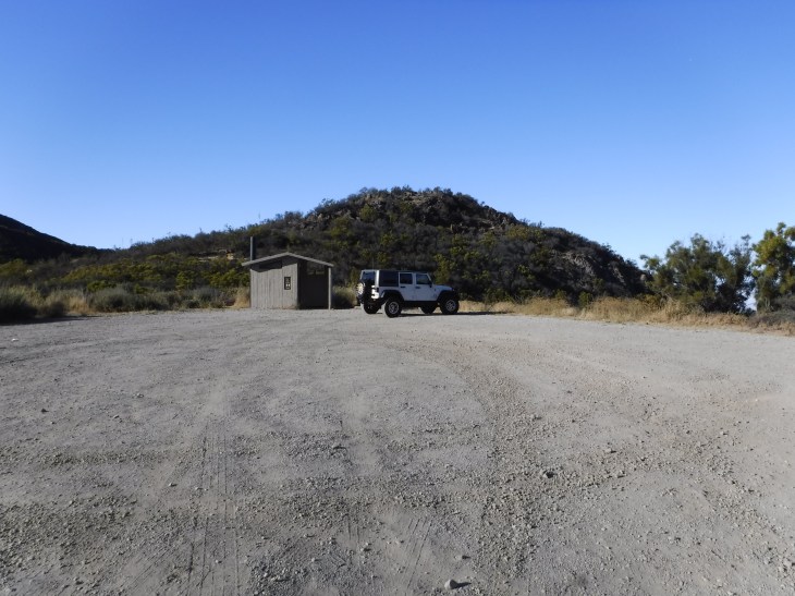
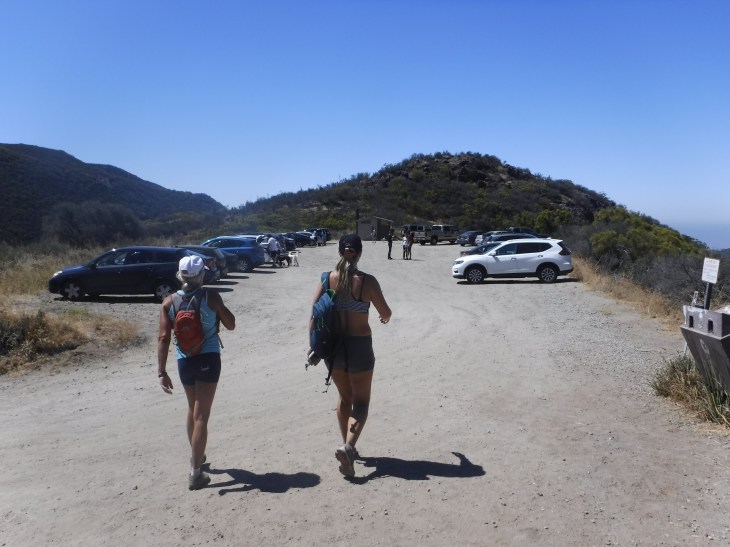
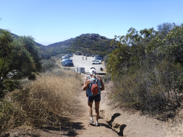
There is plenty of parking at the trail head with a restroom. This is a heavily trafficked hike on the weekends. There is additional parking east of the trail head for overflow.
The Hike
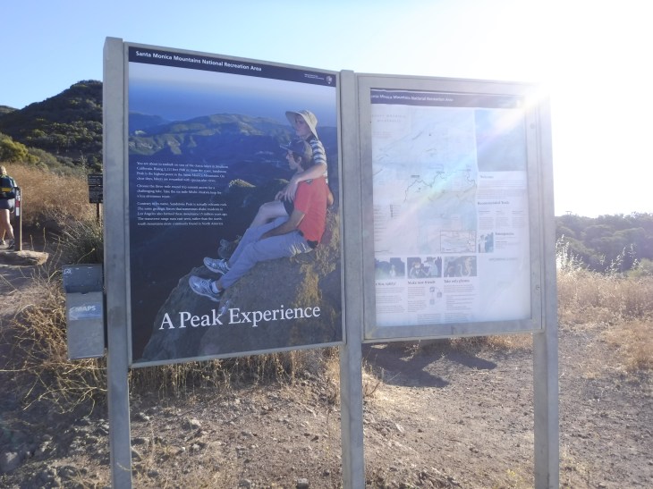
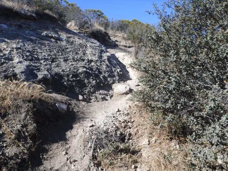
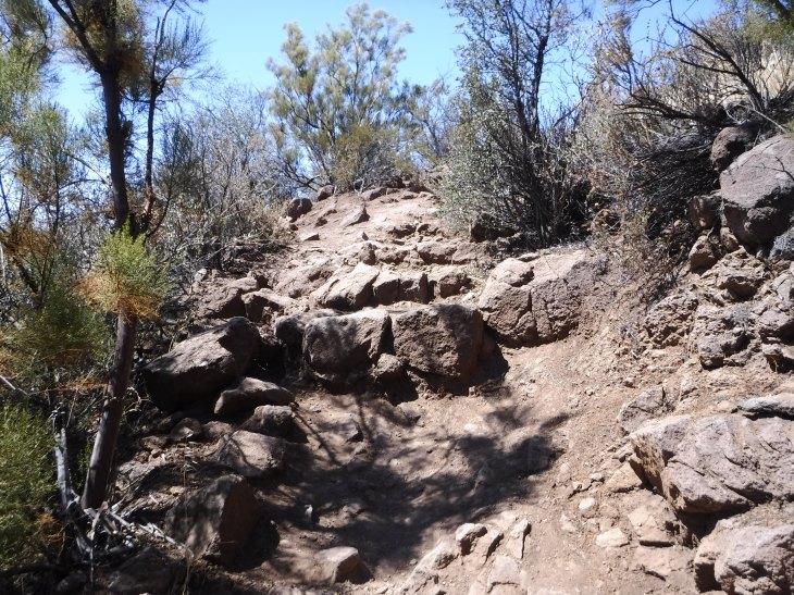
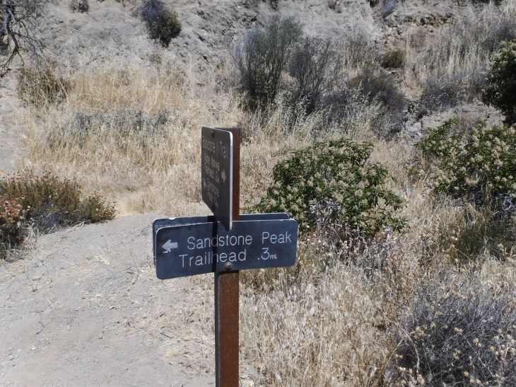
The parking lot leads directly to the Sandstone Peak trail head. Just beyond the trail head sign, to the right, you will see a large rock and a picnic table. This is one of the few areas on this hike that you will have cell phone reception. I’m just sharing this at this point in case you’re super excited and want to post something on social media. This is one of your few chances. From the very beginning of the trail head you begin to go straight up a dry, rocky, rutted dirt path for 0.3 miles.

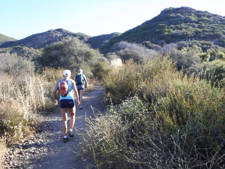


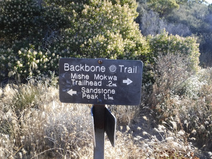
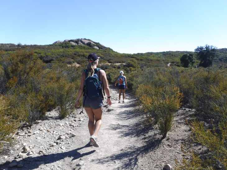
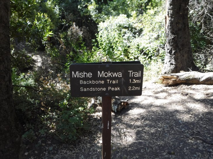
After the first 0.3 miles you are given a choice. You can proceed to the left onto the Backbone Trail. This leads you to the peak in 1.1 miles. I have always gone left to the Backbone Trail. At first it is the most difficult choice, this is where you will gain the 1,600 foot of elevation. Once you have summitted the peak the rest of the hike, approximately 4.5 miles, is for the most part downhill. There are a few small hills. All of the Internet sites that I reviewed suggest going to the right onto the Mishe Mokwa Trail. If you choose to take the trail this way, you will have a slow, slight, incline for the majority of the 4.5 miles. There is always more traffic going in this direction. You will have a climb to the peak and then downhill trek again going this way.
On the way up to the peak there are multiple opportunities to take pics. This section is steep and exposed to the sun. Hydrate. Stop, rest, take photos and enjoy the beautiful vistas.

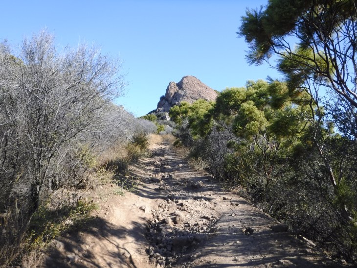
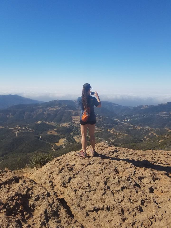
You will eventually come to a set of stairs that will lead you to the peak. It is clearly marked as you will see. However, each time I come here, I notice that hikers have gone off trail so often in one area that it is starting to look like a legit trail. Please don’t take this. You can reach the peak this way, but most first time hikers just get lost. We ran into a couple who did just that this morning.

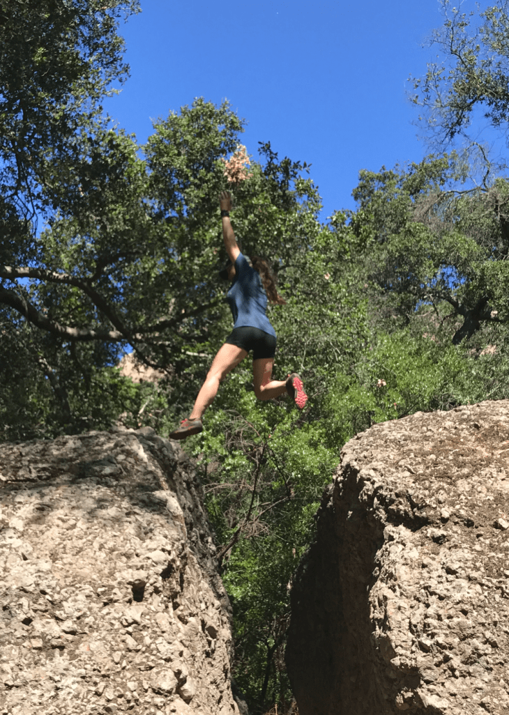
Once you get to the top of the stairs you are going to start climbing up that pesky igneous rock. You will billy-goat it up to the top. Or climb, but I really like saying billy-goat. You will want to go up and left, up and left, up and left and you will find yourself at the peak. We were fortunate enough to have the peak to ourselves. I have seen up to 30 people there on previous trips.


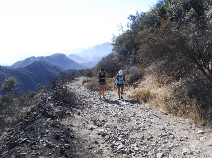
After rest, snacks and photos we were back on our way. This is my favorite part of the trail. I will describe some of the highlights of this leg of the hike.


Following the Backbone Trail you will soon find yourself at Inspiration Point.


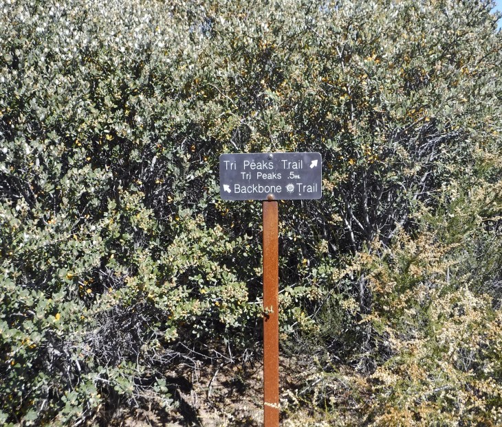
Next you will find a trail sign that points you towards the Tri-Peaks. It is so amazing to me that you find yourself 1/2 mile from Tri-Peaks which is just beyond Boney Peak. Who knew Newbury Park was so close?

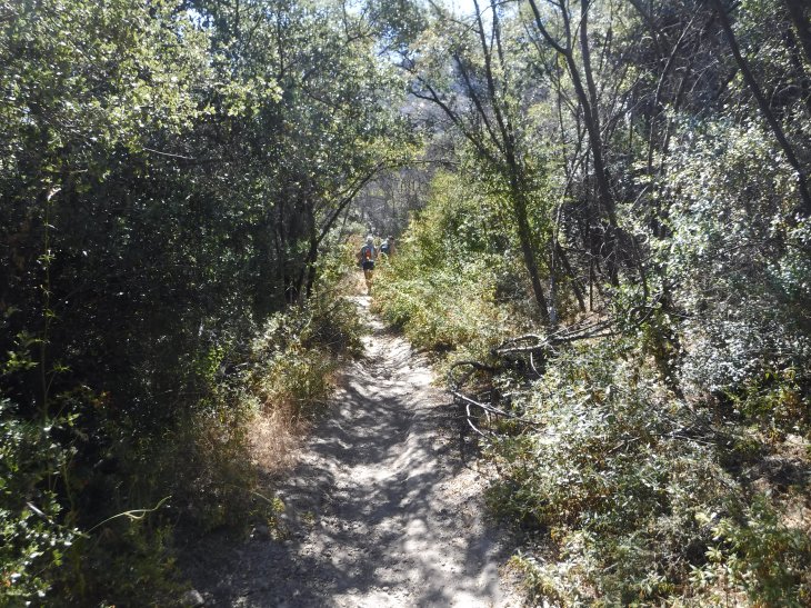
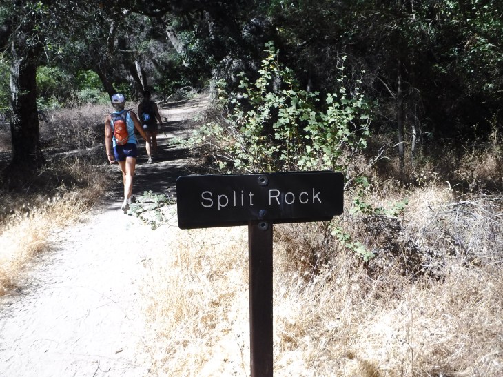
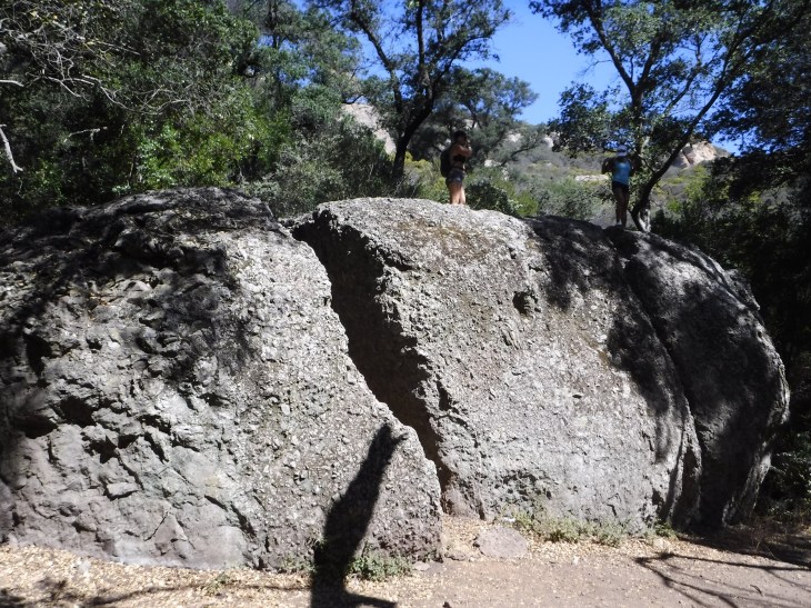
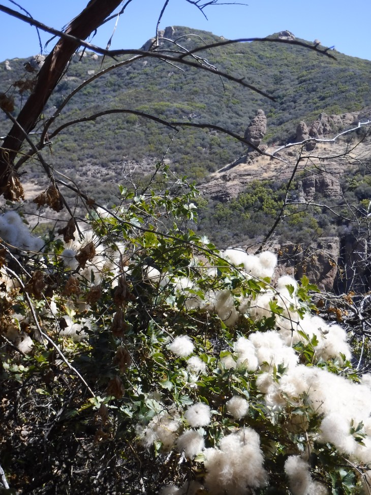
On this portion of the trail there are streams in late Winter and early Spring after the rains. There were several wet crossing here this past January. Bone dry today. The terrain changes a bit on this portion of the trail. There is some tree protection from the sun here. You will pass Skull Rock on the way to Split Rock.
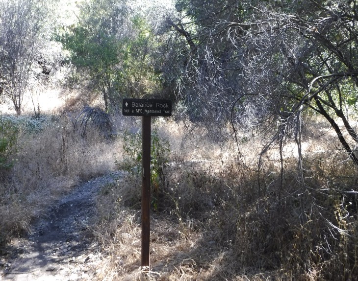
One of my favorites, Split Rock. It’s a nice place to rest and have a snack. I enjoy sitting on top of the rock and watching people come down the back way from Mishe Mokwa trail. The always look left and right trying to figure out which way to go. And they always pick left. You should go right. It’s amusing to watch. I tell people who go left they are going the wrong way. Some go that way anyway. They’ll be back soon. It’s a loop back to Split Rock. Just before you get to Split Rock there is a sign for the trail to Balance Rock. The trail is not well maintained and full of poison oak. I’ve done it once with my friend Wanda. We peaked the wrong mountain, boys were shaking bushes to be found, and there were injuries that needed stitches. It’s a story for a different blog. That being said, it was cool once we finally got there.
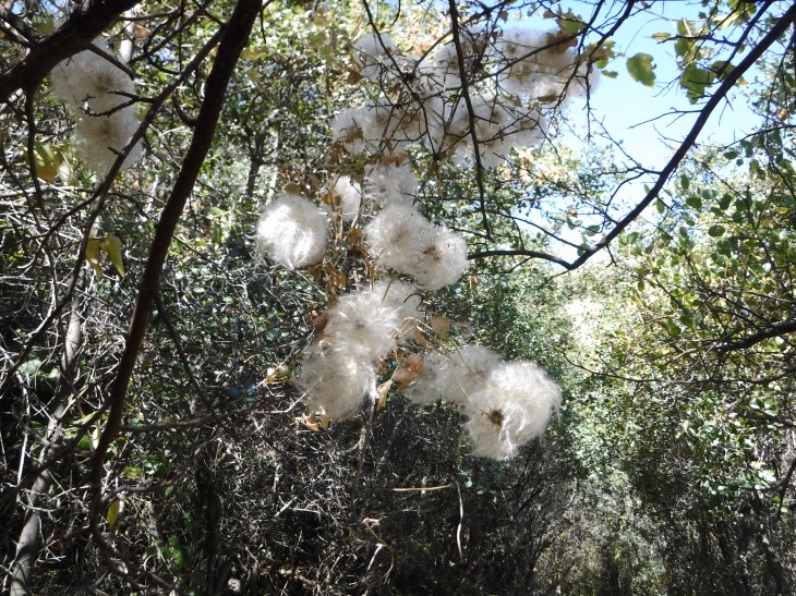
Once you have rested (or not) you will be going up a quick incline. There was quite a bit of poison oak on this portion of the trail. You will see Balance Rock to your left for some time. On this portion of the trail there will be moss, ferns, manzanita, red shanks, and holly-leaf cherry shrubs.


Toward the end of this portion of Mishe Mokwa Trail you will have two options to chose from to get down. Go right. The left leads to the road and not the trail.

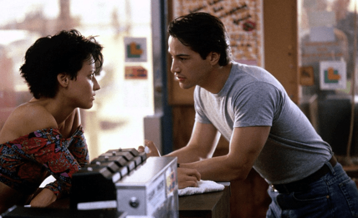
We decided to treat ourselves for lunch. When you drive the 6 miles back on Yerba Buena Road to the PCH you will find Neptunes Net on the right. Some of you may remember the original Point Break movie with Keanu Reeves. He was my Hollywood crush at that time. His character, Johnny Utah goes to Neptunes Net to meet Lori Petty’s character. Does anyone remember that kiss they had on the surf boards? I hated Lori Petty. But I digress…

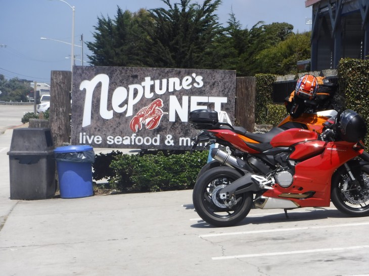

If anyone has traveled the PCH on the weekend they know the huge crowds, especially bikers and surfers, that go to Neptune’s Net on the weekend. It was Monday. 11:30 am. There were no crowds. We had a good, reasonably priced lunch. With full bellies we headed home. Now, on to the next adventure.
