Each of us hike for our own reasons. All hikes have their own personalities and we develop a relationship with each. I have fallen madly in love with two hikes. Like a teenage love which is strong and pure and painful and defies all logic. The first is Mt. Whitney. She is a humbling task master who forces us to acknowledge how small in the universe we truly are. I visit her annually. She feeds me spiritually and I feel the draw to return to her each summer. The second is along the Sespe Creek in Rose Valley. She is a beauty that changes her leafy wardrobe with the seasons. The picture above is Bear Creek taken in the late summer/fall when the Aspens put on a spectacular show. When you hike this area you feel removed from the urban/suburban areas that so closely surround it. Hike far and long enough and you will be treated to big horn sheep, bears, moutain lions and steel head trout. But not on the hike I will describe in this post. Today is about the hike along the Sespe Creek which will lead you to Bear Creek.
History
As with many of our hikes in California the name of Sespe Creek is derived from the Native Chumash. The name Sespe can be traced to a Chumash village, called Cepsey, Sek-pe or S’eqpe’ in the Chumash language. This translates to kneecap. The village was mentioned in a Mexican Alta California land grant called Rancho Sespe or Rancho San Cayetano in 1833. This particular hike is just north of Ojai Valley. The Chumash were early inhabitants of the Ojai Valley. They called the valley ʼawhaý, or the moon. Moon Valley. The origin of the name Rose Valley is a little more difficult to determine. I have found three explanations. One states that the Valley is named for the wild roses growing in nearby hills. I’ve never seen roses there, but this explanation, for the origin of the name, is given most often. Other accounts state that it was named Rose Valley because of the rose petal-like shape of the hills. If you squint, maybe. And lastly, the Valley was named after the beautiful pink hues of the sunset in the evenings. This I have seen and the sunsets are quite remarkable.

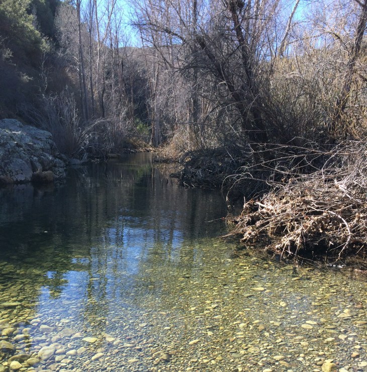
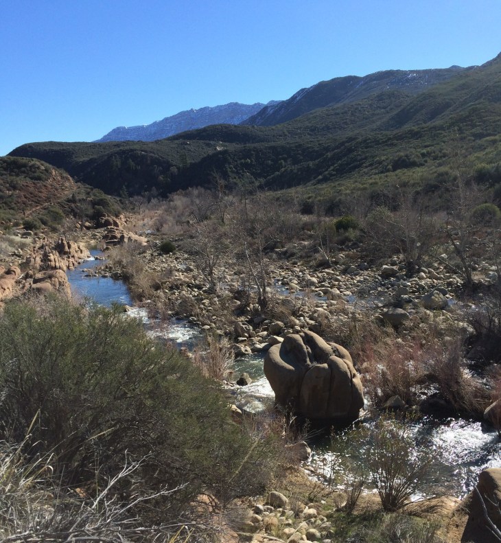
You will be hiking alongside the Sespe Creek as you travel towards the Bear Creek campsite. Sespe Creek is a stream/River which is 61 miles long. It begins in the Eastern Sierra Madre Mountains and eventually empties into the Santa Clara River in Fillmore. 31 miles of Sespe Creek is designated as a National Wild and Scenic River and National Scenic Waterway. It is the last of the wild rivers in Southern California as it remains free from major habitat modifications and has no dams. It is also one of Southern California’s last free flowing Steelhead Trout streams.

The Forest Service long enlisted the help of the Civilian Conservation Corps. The Civilian Conservation Corps was the most popular of the New Deal programs created by President Franklin Delano Roosevelt to provide relief and a speedy recovery from the Great Depression. From 1933 until 1942, the CCC put two million young men to work on a massive building program in America’s parks and forests. During this time, a CCC camp was located at Piedra Blanca, the trailhead of this hike. The CCC was inclusive yet segregated. For the last three years of its existence, 1939 until 1942, the Piedra Blanca site was manned exclusively by African-American enrollees from Los Angeles. Company 2925-C carried out erosion-control projects and constructed drainage ditches and channels in the area. For more information go to: https://www.parks.ca.gov/pages/24877/files/olen_cole_jr_african_american_youth_in_the_ccc_of_california_1933_1942.pdf

Rose Valley (near the Rose Valley Water Fall which you pass on route to the trailhead) has been used for several purposes. The U.S. Navy Seabees Heavy Equipment Division constructed a base in the Valley in 1954. The Seabees have a base located in Port Hueneme, California. The division needed a larger area than provided at Hueneme to train service personnel to move heavy equipment around. The National Parks Service wanted roads built in the Valley, especially to some of the harder to reach peaks. An unlikely relationship was established between the military and the National Park Service. In the 50’s and 60’s park visitors were greeted by Quonset huts and a sign that read Where Seabees Practice ‘Can Do’. The Seabees constructed the two man-made ponds that are seen near Rose Valley Falls and several trails and roads in the Valley and surrounding peaks. The Seabees left the camp in 1972.


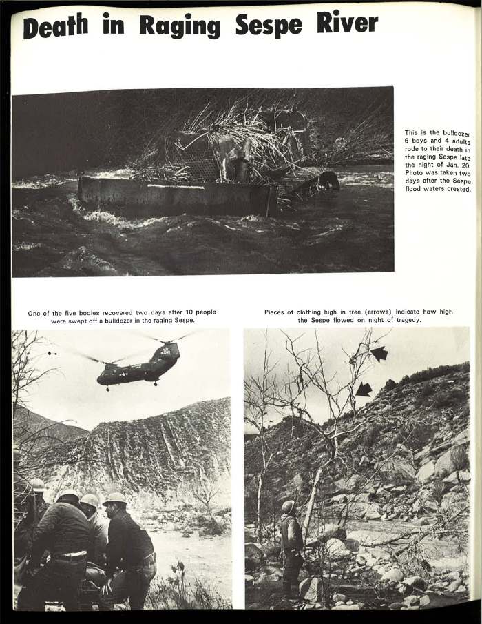
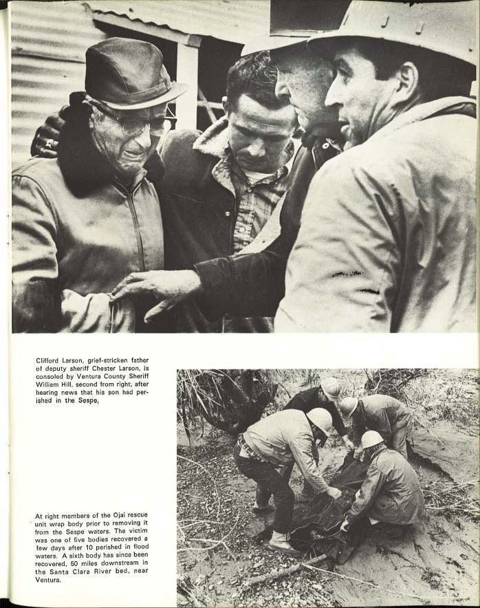
This segues into the tragic story about how, in 1969, six young boys (Bobby and Ronny Cassol, Danny and Eddie Salibury, Frank Donato, and Frank Ruah) and Robert Samples, their adult chaperone, entered into the Sespe Creek Wilderness for a camping trip. None camp back alive. In all, a total of 10 lives were lost in this tragedy. In January 1969 there was a deluge of rainstorms in Ventura County in Southern California. There was so much rain in fact that it became national news. On January 20, 1969 the Ventura County Sheriff’s Department received a phone call that the six boys from Canoga Park had not returned from a weekend camping trip. The Ventura County Sheriffs Department dispatched deputies Gary Creagle and Chester Larson to Lion Campground. Conditions were dismal with the rivers swollen beyond their banks. Helicopter rescue was impossible due to the rains and high winds. Chester Larson suggested using one of the 15.5 ton bulldozers from the Seabee Training Center to search for the party and bring them back. Chief Equipment Officer Robert Sears volunteered to drive the bulldozer. A Forest Service Ranger James Greenhill, who was familiar with the area, volunteered to go as well. The rescue party of Sears, Larson, and Greenhill, after successfully crossing the river nearly a dozen times on the bulldozer, found the campers safe in a cabin at Coltrell Flats. How the story unfolds is told by Scott Eckersley, who was trapped in the cabin with the other campers. He is the only one to survive the night. This story is important as there are several lessons to be learned about safety on the trail from this tragic event. To read the entire story I suggest going to https://www.outsideonline.com/1825311/hell-high-water or https://songsofthewilderness.com/2016/01/11/trail-quest-1969-floods/
When the Navy pulled out of the area in 1972, the site was briefly used by the Youth Conservation Corps, the Young Adult Conservation Corps and a Forest Service helicopter crew. In 1988, The Ventura County Sheriff’s Department offered the Forest Service $1.3 million to renovate the site to create a minimal security jail. The “work camp” was created to ease overcrowding in the Ventura County Jail. The inmates found themselves in a boot camp-type setting, wearing uniforms and marching six times daily. The camp offered job training, substance abuse classes and auto mechanics. The work camp was a victim of budget cuts and closed in 1992. This site was then re-purposed as a site for the Concerned Resource Environmental Workers (CREW). CREW was established to help at-risk youths age 14-21 to learn job skills. The CREW program acted as a labor force to maintain the forest and trails. The participants were paid by through donations to the program. The CREW program left Rose Valley in 1996. The site has been abandoned since that time.

Hike Statistics
Type of Route: Out and Back
Distance: 9 miles
Elevation: 2820 feet
Elevation Gain: 250 feet
Time: 4-6 hours
Difficulty: Easy to Moderate
Dogs Permitted: Yes, On leash
Permit: A National Forest Adventure Pass is required to park at the Piedra Blanca Trail head

Day ePass and National Forest Day Pass
Cost
$5 per day generally
Benefits
Honored at all Forest Service operated recreation sites in Washington and Oregon where a day use fee is required.
Allows the pass holder and any accompanying passengers in a private vehicle use of the recreation facilities.
Allows the pass holder use of recreation facilities at per-person sites. Other members in the party must pay the per-person fee.
The day pass is also convenient for second vehicles when the second vehicle will not be attached to its primary vehicle.
Validation
Day ePass
Purchased online and printed at home.
The pass is validated at the time of purchase for the date selected by the visitor.
Can be validated for same day that it is purchased.
Any modification to the pass (such as changing the date) will void the pass and may result in a warning notice or a violation notice.
Only good until midnight for the day the buyer validates it for.
National Forest Day Pass:
Purchased in person at Forest Service offices, or local vendors. Can be purchased online, but visitor will incur a service charge and must wait for the pass to arrive in the mail.
Self validating and will be validated by the visitor prior to use.
Visitor will validate pass by printing clearly, in ink, the month, day and year they use it. Improper validation (incorrect / illegible date or modification) by holder will void the pass and may result in a warning notice or a violation notice.
Only good until midnight for the day the buyer validates it for.
Display
Display pass on dashboard on the driver’s side. For multiple days, a pass for each day must be visible in the vehicle.
https://www.fs.usda.gov/detail/r6/passes-permits/recreation/?cid=fsbdev2_027009
You can find out where to purchase passes online. Many local Big 5 stores sell them.

The Hike
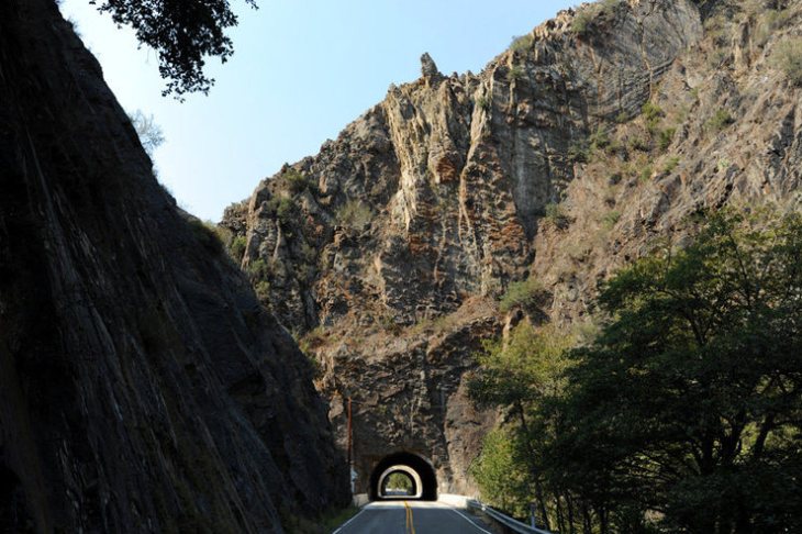
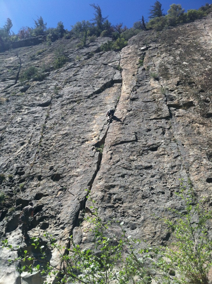
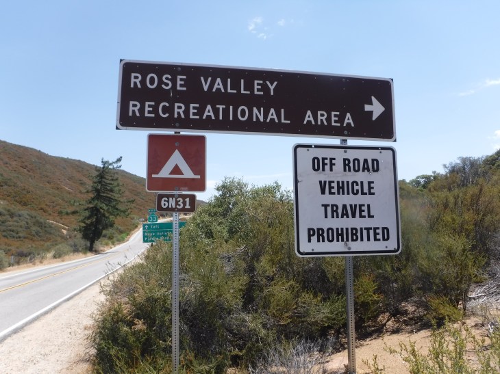
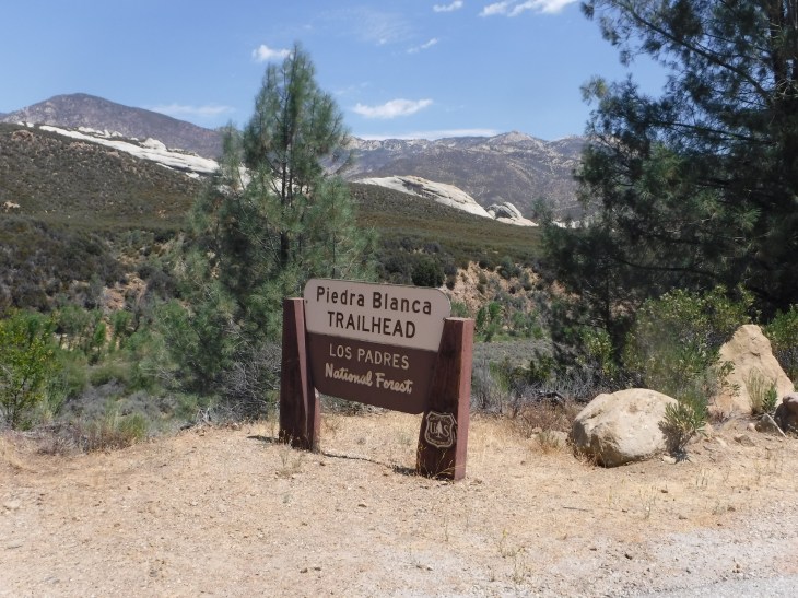
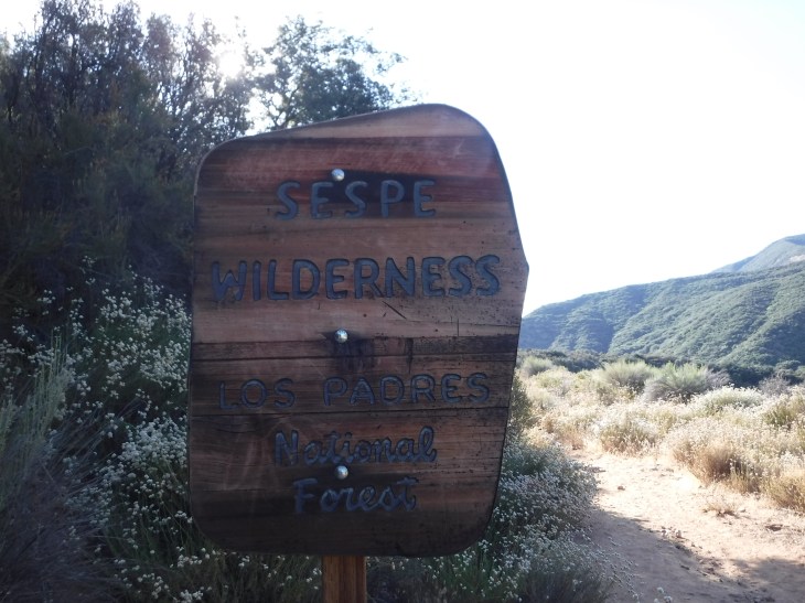
The trail is just north of Ojai. It is part of the Sespe Wilderness and is the largest wilderness area within the Los Padres national Forest at 342 square miles. To get to the trailhead, go to Ojai and turn onto Rt 33 (Maricopa Hwy). You continue on Maricopa Hwy for 13 miles up a mountain. Along the way you will go through three tunnels. Occasionally you will see climbers on ropes scaling the black walls of the canyons that surround the highway. You will gain quite a bit of elevation and notice the temperatures dropping along the way. It warms up again as you enter the Valley. You turn right at the Rose Valley sign and take the road for 5.6 miles to the end at Piedra Blanca Trailhead.
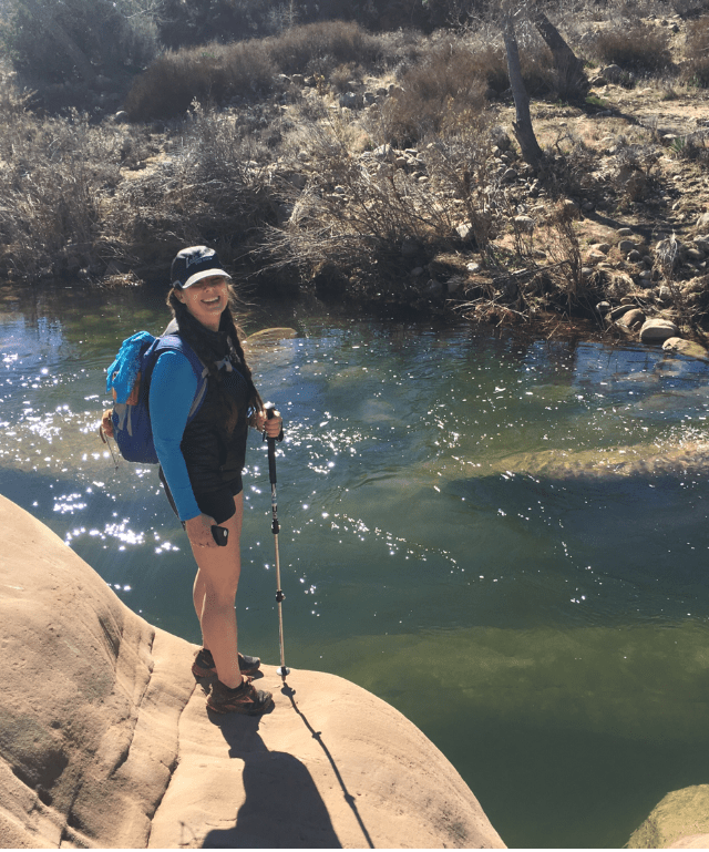
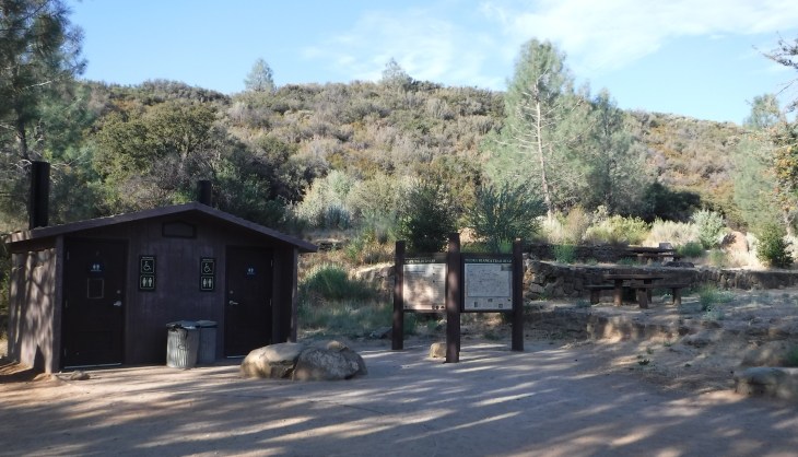
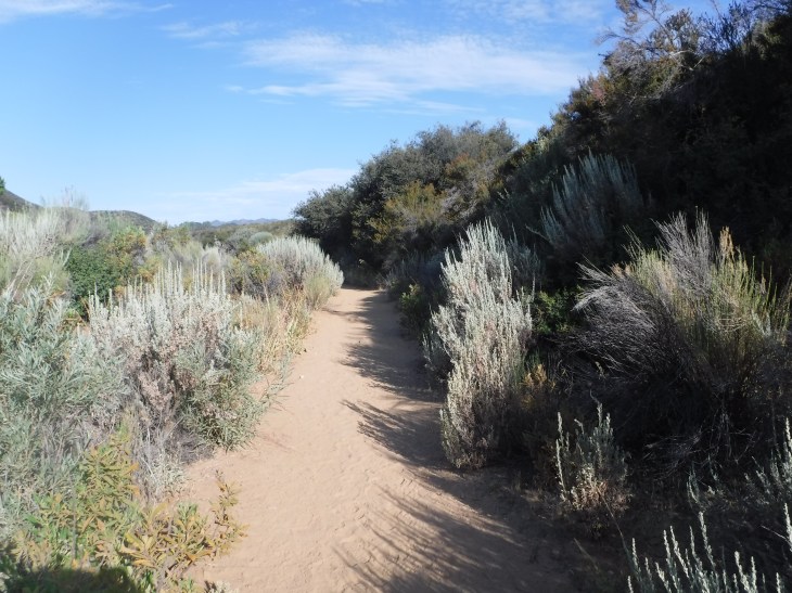
This hike is very straightforward and relatively flat. I begin the hike at the parking lot of the Piedra Blanca trailhead. There are picnic tables here and a restroom. The trail head starts left of the restrooms. I can’t emphasis enough to get an early start. The trail temperature starts low before sunrise, but quickly rises above 100°F. The temperature was 104°F when we came out of the trail on this hike. Bring ample water, 2-4 liters, and snacks.

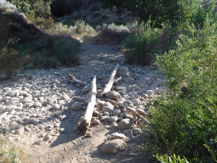
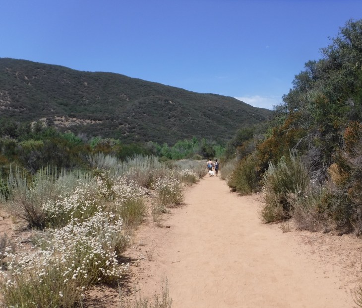
The trail goes quickly down to the Valley floor which is intersected by streams. In the winter you may be rock hopping to get across. On this hike in July, all of the crossings were dry.
In 0.4 miles you will come to a crossroad on the trail. Going left leads to the Piedra Blanca area. Piedra Blanca trail is a great hike. For this hike you will veer to the right.
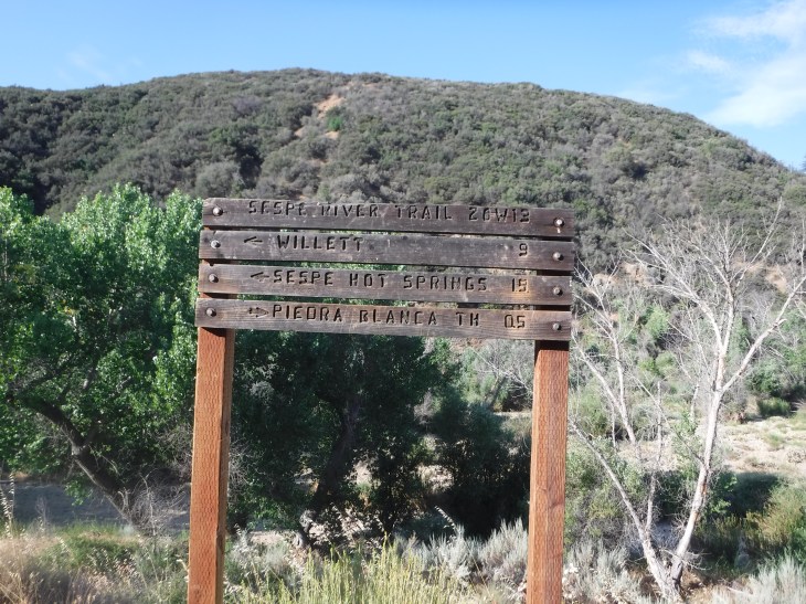
Once you are headed towards Willett, there is no way to get lost getting to Bear Creek UNLESS YOU GO OFF TRAIL. Stay on the trail. Enjoy the beauty of this amazing Valley welcoming you into her wilderness.


I have backpacked to Bear Creek for a weekend of camping. It was a good beginners backpack trip. Mostly because it is short (4 1/2 miles) and you are very close to the parking lot should you need to get out. This is a popular site. Come early. The best spot is just in front of the creek. It has a flat surface and trees for hanging hammocks. No fires are permitted. Many backpackers go beyond this point to Willet Hot Springs (18 miles round trip) or Sespe Hot Springs (30 mile round trip).


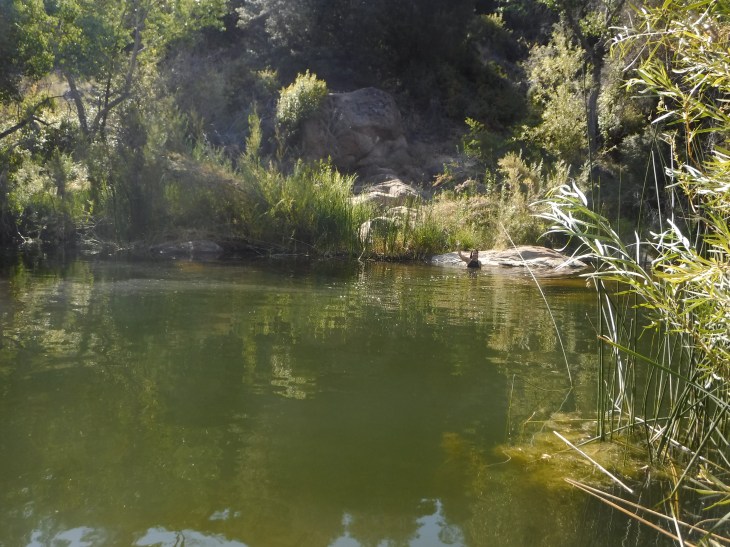

After a swim and a snack, it’s time to head back. Remember that it is hot in the summer with almost no shade in the late morning/afternoon. Use sunscreen. Wear hats. If you sweat a lot, electrolyte replacement drinks are a must.
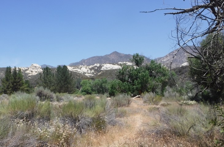
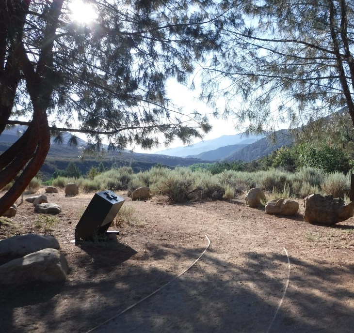
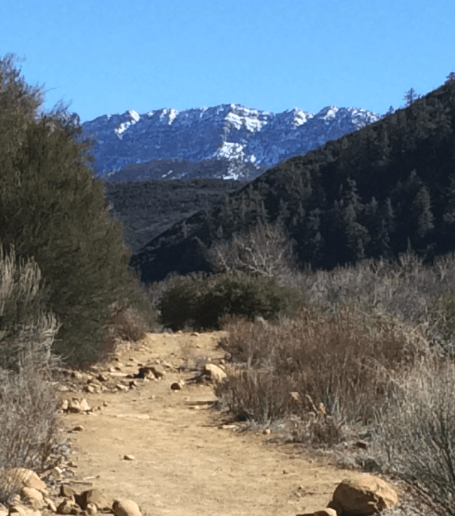
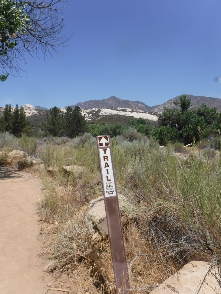
You can see to the right of the picture below pine trees. These trees are very important to me on this hike. When I see them over the ridge on the way back I know there is just a little more than a mile left to the hike. Almost done at this point.
There are multiple side trails to get down to the water with camping sites along the way.
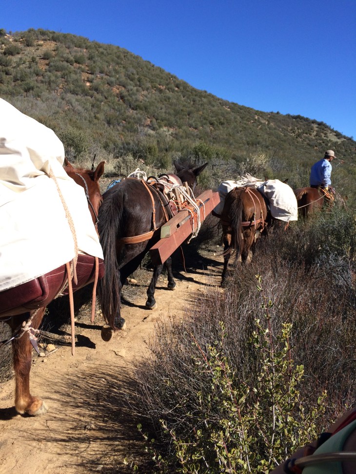
The trail is moderately traveled though never crowded. I find the travelers on this trail very nice. I like to chat people up on the trail. I have found out about several awesome trails by talking with fellow hikers along the way.
A view of the Piedra Blanca and you are 0.4 miles to the parking lot.
I truly hope for you that you will be able to visit this trail. You will find yourself feeling so far out in to the wilderness and marvel that a place so beautiful is so close to home. But for now, on to the next adventure… Gaviota Peak.