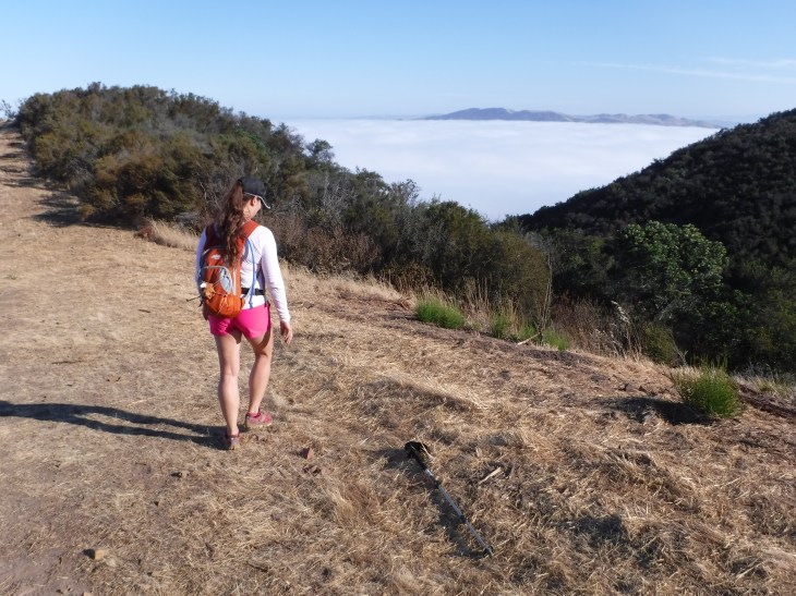
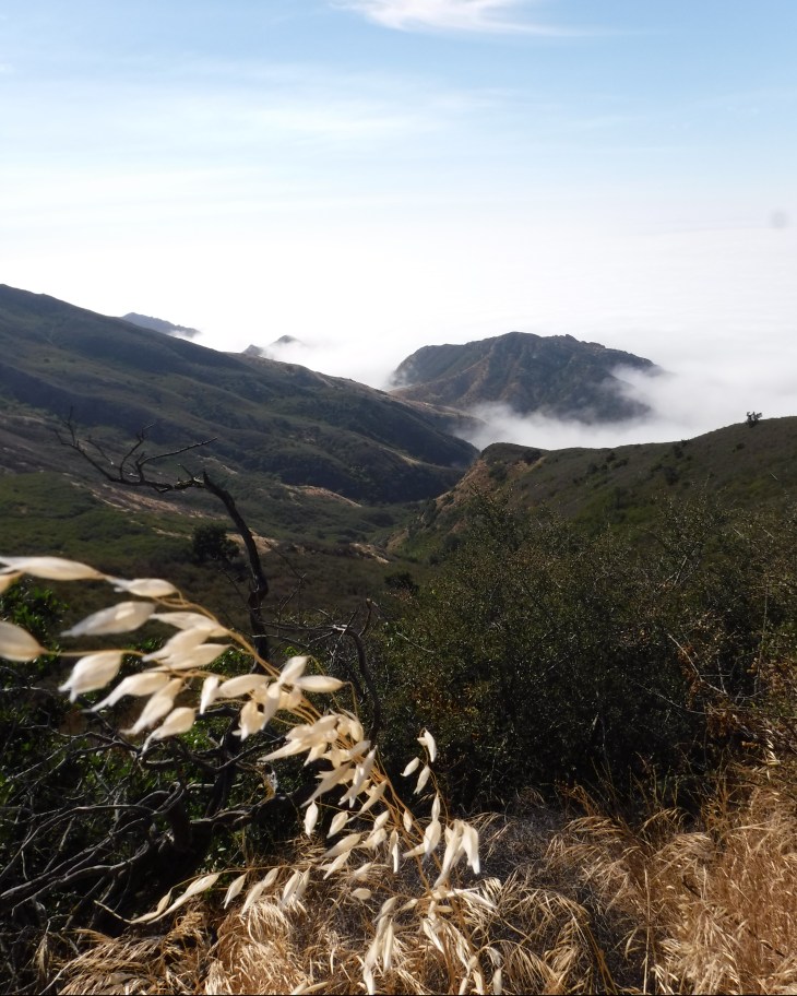
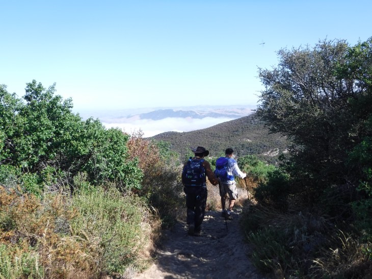
The first time I heard of Gaviota Peak I was told that it would be a good training trail to prepare for hiking to the summit of Mt. Whitney. I enjoy this hike more each time I do it. The trail highlight for most are the hot springs pictured above. Clothing is optional at the hot springs. You never know what you are walking into there, you are now forewarned. The peak offers panoramic views of the Pacific Ocean and the Channel Islands which are breathtaking. That is, when you reach the summit on a clear day. I’ve got about a 50% success rate on that one, and on this hike the mountain was socked in with fog. It is still beautiful to be up on top and see the marine layer nestled among the mountain tops. You can take one of two trails to get to the top. There is the Trespass Trail which is a 6.5 mile loop. It is named Trespass Trail as the majority of the trail winds through private property. The property owner allows hiker to “trespass”, but only on the designated trail. It is said to be lovely with the majority of the trail giving you views of the Ocean. I take the more traditional Gaviota Peak Trail which is 6.3 miles out and back. It is much steeper than the Trespass trail. Which is good, I was in training. Gaviota Peak trail is lined with the most incredible old trees. Both trails are located within the Gaviota State Park and the Los Padres National Forest. The peak is part of the Santa Inez Mountains.
History
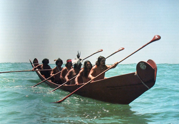
For thousands of years Gaviota was Chumash territory. The Chumash hunted or trapped local game, caught fish and gathered shellfish, plants, berries and roots. They were outstanding at building boats. The boat for which the Chumash were best known was a large and highly capable sewn-plank canoe called a tomol. The tomol has been called “the single most important, valuable property in the Chumash economy” and “one of the most sophisticated technological innovations in precolonial North America,” and described as ” the most sophisticated and laborious-to-build large watercraft of the New World, requiring costly materials and some 500 man-days of skilled labor to construct.”(Arnold, 2007).
They were also skilled in bead work, basketry, and wood carving.
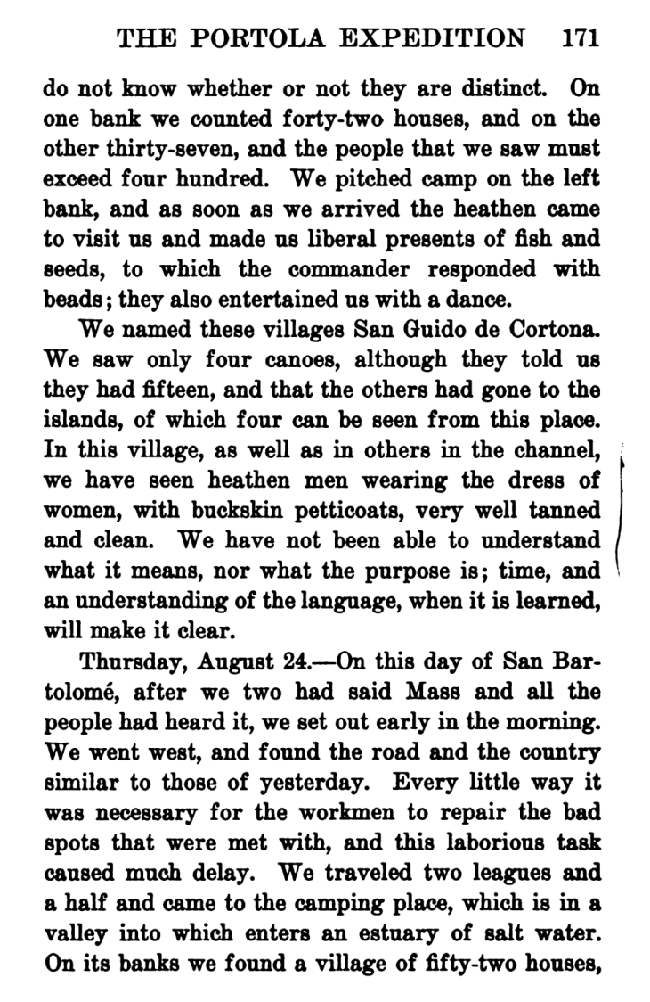
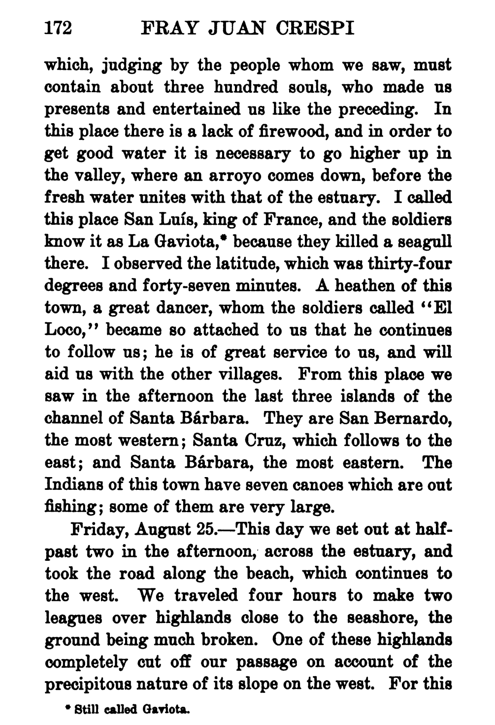
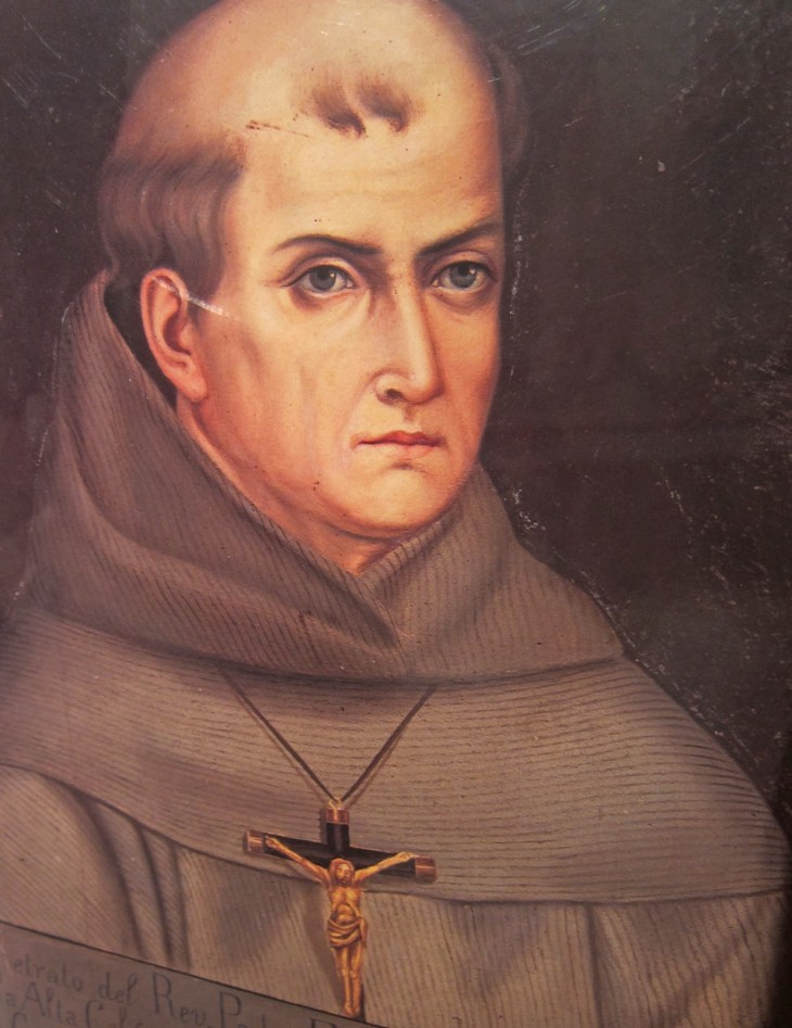
There were two Chumash villages that made up present day Gaviota: Kuya’mu and Mikwi (http://www.independent.com/news/2010/jul/15/maria-de-los-angeles-chumash-princess-gaviota/). The first European explorers to come to California were from Spain. In 1769, a Spanish land expedition, led by Gaspar de Portola, reached the Santa Barbara area. Very quickly five Spanish missions were built in the Chumash Territories. One of the travelers on the Portola expedition was Father Juan Crespi, a Franciscan Monk. Father Crespi kept meticulous daily records in his diaries about the experiences of the expedition. His diaries allow historians, and us, a glimpse into the life of a Chumash village, despite his ethnocentric slant. In his journal he noted; “I called this place San Luis, king of France, and the soldiers know it as La Gaviota (spanish for seagull), as they killed a seagull there”. The name Gaviota has appeared in Spanish documents as the name of the town since 1795. Crepsi’s entire journal (translated to English) is available for free at https://catalog.hathitrust.org/Record/000288788. I will share the two pages related to Gaviota here. It’s a good read.
During the Spanish Mission period in California, the Catholic Church was forcefully converting the Chumash people to catholicism and, in the process, introduced catastrophic fatal diseases. The Chumash People were moved from their villages to the Franciscan missions between 1772 and 1817. The close confinement of so many people in the missions placed the Chumash at great risk of contracting European diseases. The Chumash had no defense against these diseases and their population was decimated. By 1831, the number of mission-registered Chumash numbered only 2,788, down from pre-Spanish population of 22,000 (http://www.santaynezchumash.org/history.html). Today Chumash community member work to revive what is becoming a forgotten way of life. The current population is nearly 5,000. There is a Chumash reservation in Santa Ynez near Gaviota. This is the only federally recognized Chumash band though several other organized groups do exist (https://www.nps.gov/chis/learn/historyculture/nativeinhabitants.htm).

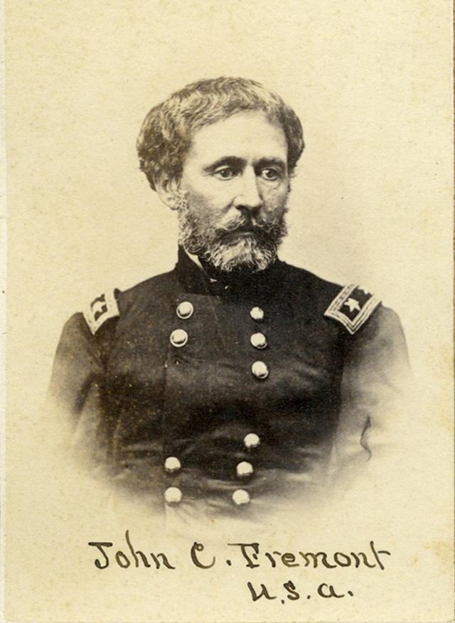
Gaviota Pass, which has a tunnel just 1.9 miles from the trail head, is widely touted for something it almost was in California history. John Charles Fremont (January 21, 1813- July 13, 1890) was an American military officer and an early explorer and mapmaker of the American West. He was one of the principal figures in opening up the region to settlement and was instrumental in the U.S. conquest and development of California. In 1846, war was declared between the United States and Mexico. From August 4th through the 5th, Commodore Robert Stockton, commander of American forces in California, anchored his ship in Santa Barbara and captured the town then left a small garrison in charge. The Stockton garrison was captured by Mexican forces on October 1st and 2cd. On December 27, Major John C. Fremont was to lead American reinforcements over Gaviota Pass to Santa Barbara and recapture the town. As he was marching towards Gaviota Pass, Fremont got wind of a planned ambush by the entire Mexican garrison of the Santa Barbara Presidio. He then changed course and led his men over the more rugged San Marcos Pass and seized the then unprotected city of Santa Barbara. Fremont is the first to ever raise the American flag in Santa Barbara. Some historical accounts report that he did go through the Gaviota Pass toward Santa Barbara. Some historians report that none of this ever happened as the Mexican garrison was in Los Angeles. Who knows? The majority of historians agree it was San Marcos Pass.

Fun Movie Trivia
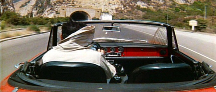
The Gaviota Tunnel has been featured in three major movies, The Graduate, Waynes World 2 and Sideways. In the first two films Dustin Hoffman and Mike Myers are supposed to be going southbound per the movie plot. This tunnel only goes in the northbound direction. There are no southbound lanes. So those of us in the know know that they are going the wrong way…Oopsie! In Sideways, Paul Giamatti and Thomas Haden Church are heading north and therefore pass through the tunnel in the correct northbound direction.
Hike Statistics
Type of Route: Out and Back
Distance: 6.3 miles
Elevation: 2458 feet
Elevation Gain: 2150 feet
Time: 2-4 hours
Difficulty: Moderate+
Dogs Permitted: No Dogs
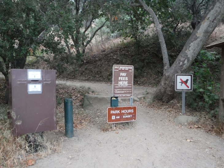
Permit: $2.00 parking fee


The Hike
If you are traveling northbound on U.S. Route 101 you will have the opportunity to go through the Gaviota Pass tunnel found just 1.9 miles south of the trailhead. There is a wonderful article full of great pictures about the history of Gaviota Pass and the tunnel at http://goletahistory.com/the-gaviota-pass/. The Gaviota Peak Trail starts near the junction of the 101 and California State Route 1. You will turn off the freeway at Exit 132 towards Vandenberg Air Force Base.

The trailhead lies at the south end of a very short spur road at the east side of the 101 and Hwy 1. There is usually ample parking. I have seen several cars parked on the side of the road north of the trailhead to avoid the $2.00 parking fee. That’s ok. The trail is part of the California State Park system and is patrolled by park rangers. Pay the $2.00 fee. It helps to maintain the Park. You will be ticketed if you don’t. The fine is a hefty $71.50.


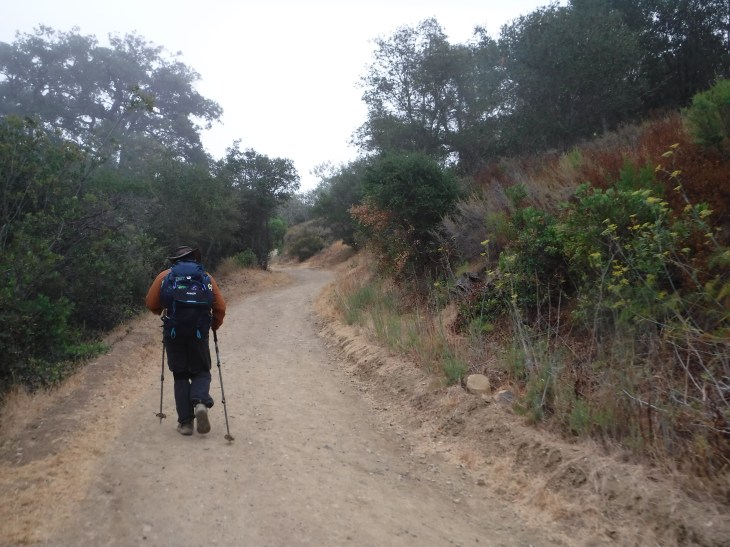
The elevation begins immediately. There is no honeymoon on this train. You will climb 150 feet over the first 0.25 miles. At this point you will come to the junction with Trespass Trail.
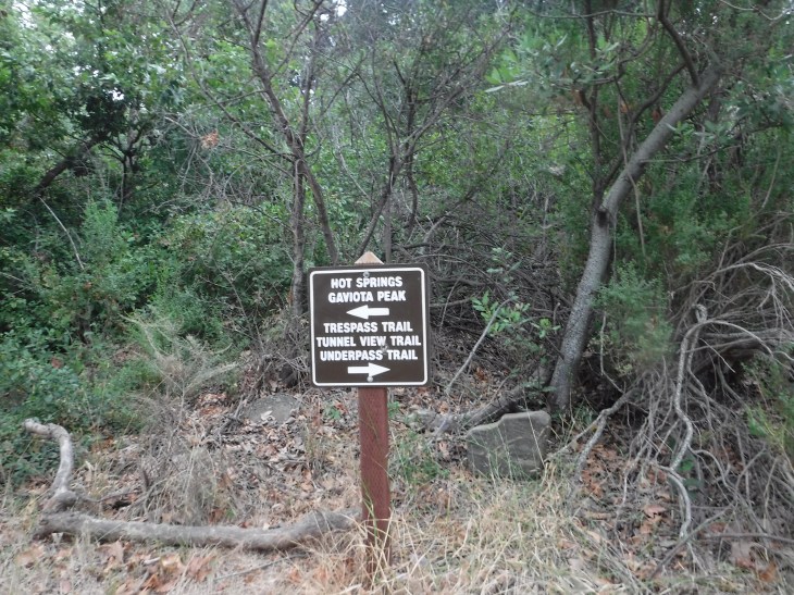
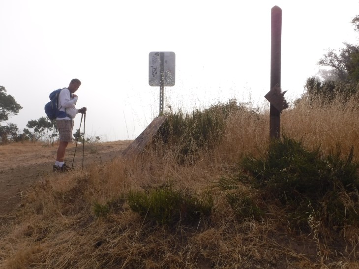
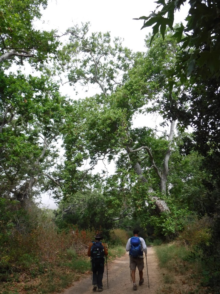
Trespass Trail (3.35 miles to the top) is a narrow singe-track trail said to have stunning views of the Pacific Ocean. The elevation gain is much more gradual than Gaviota Peak. I’ve only gone to the peak on the Gaviota Peak Trail (3.15 miles to the top). It’s views are not as great as those said to be found on Trespass trail though is it lovely with the numerous ancient trees and valleys. You do have views of the ocean as you get toward the peak. You can of course enjoy this hike as a loop, hiking both trails. Very quickly, approximately 0.1 miles, you will come upon an unmarked single-track trail that leads off to the right towards the Gaviota Hot Springs. We passed this as we headed towards the summit but visited the springs on the way down.

You are now going to come to the only spot on the trail where you may actually lose some elevation. You go down and through a grassy field before heading up the mountain again. In the winter it is beautifully green. In July it was dry and brown and there is no shade from the sun. When you have traveled about one mile you will be back in the spotty shade. Here you will find yourself going around a metal gate which I believe is there to keep vehicles off the trail. The trail is really a fire road.
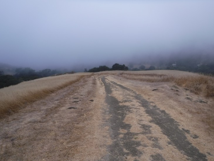

You will ascend just over a thousand feet in the first 1.6 miles. Holy Moly! Bring lots of water on this hike. You are now entering the Los Padres National Forest.

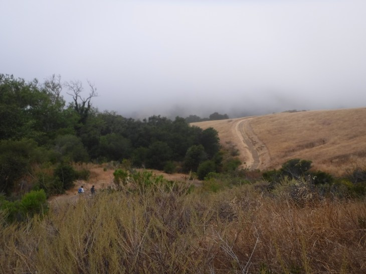
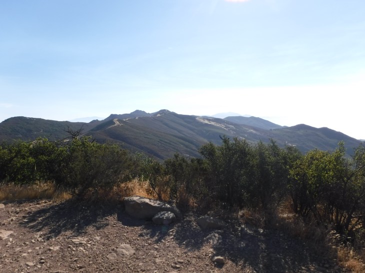
You will travel another 1.4 miles before coming to the saddle junction just below the peak. You will have had a few glimpses of the Pacific Ocean. You have now gained another thousand feet in elevation! You are most likely a little red in the face from the effort you have put into getting to the junction. It really is a great hike to train for the larger peaks in Southern California. Or anywhere. The views here are beautiful.

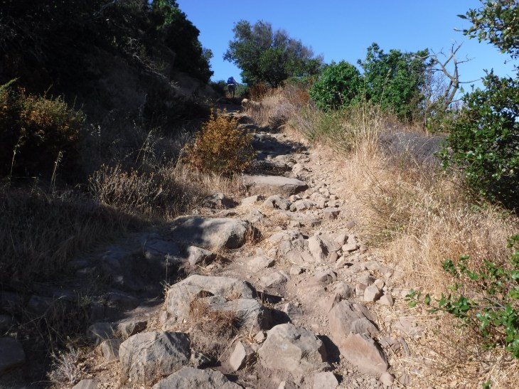
You turn right at the saddle and head up the last quarter-mile to the summit. This is the most difficult part of the hike in terms of steepness. You are not longer on the fire road. This is a single-track dry rocky path.


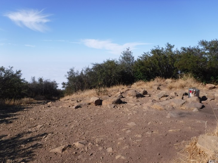
There is a register at the top to record your momentous achievement. There are several flat surfaced rocks to rest on before you head back down the mountain.


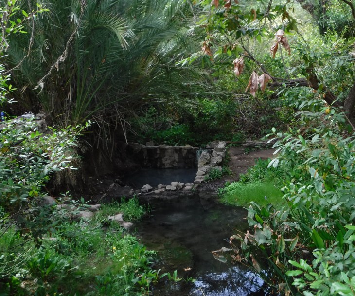
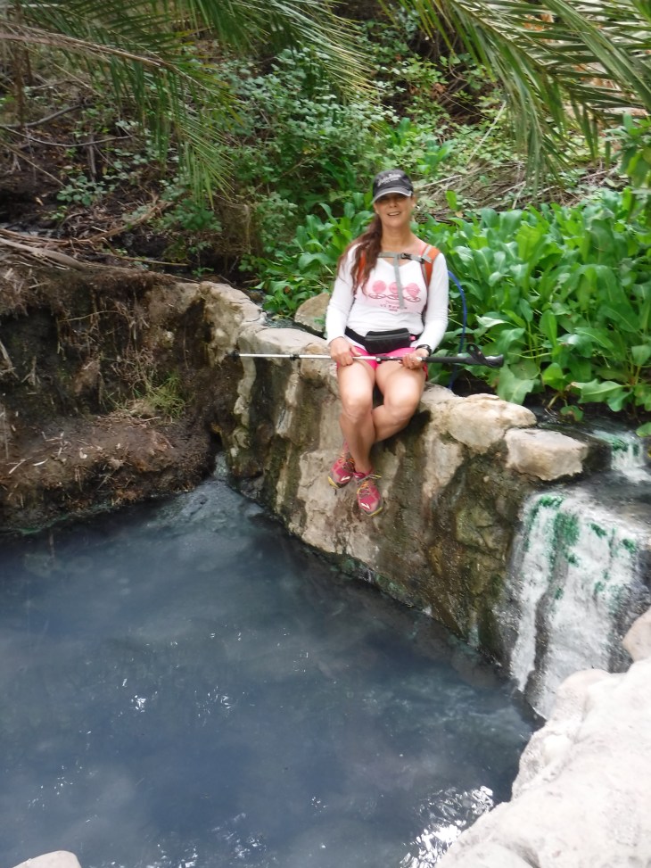
On the way down we take a side trip to the Gaviota Hot Springs. You will smell the sulfur from the springs long before you see it. Beware! The trail is overrun by poison oak. Aside from that, it is the prettiest section of the trail. I have never been to the springs and found it empty. Today was no different. Many people visit the springs to soak and relax. At some point concrete was poured in the area to collect the water and form the pools. While it is called a hot spring, the water is more warm than hot. It is a nice place to stop (if you can stand the rotten egg smell) and rest your tired hikers feet.


Going through the beautiful green vegetation to the lower pool.


I really like this trail. It is not a casual stroll and you will most likely be tired when you are done, yet feel accomplished. I can’t wait to come back. Next time I want to try the Gaviota Peak/Trespass Trail loop.
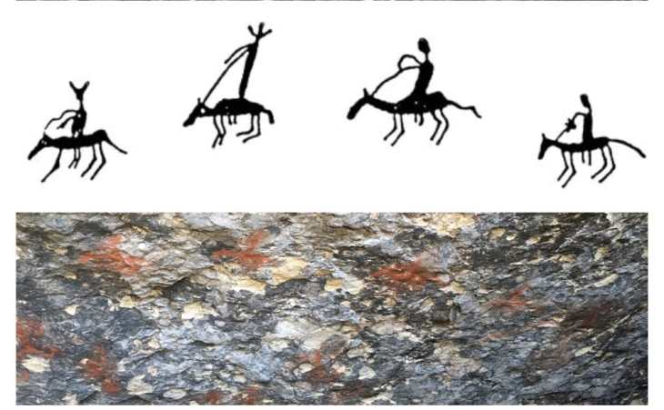
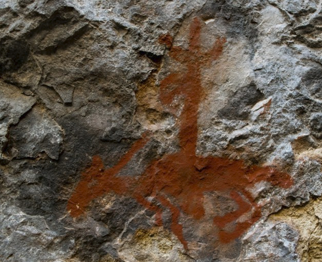
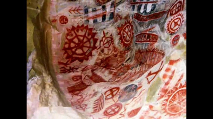
This Chumash Pictograph can be found in a cave in Malibu. It is said to be an illustration of Portolo’s expedition through the Malibu area on the way to the Conejo Valley. Father Juan Crespi, who traveled in Portolo’s party, and who I discussed in this blog, is said to be one of the four horsemen depicted in the cave painting. This segues nicely into a discussion about my next adventure. I too am on my way to hike in the Conejo Valley, this time to Hill Canyon. I hope you will follow.
